Baybiche Too
| Baybiche Too | |
|---|---|
|
Байбичетоо | |
 | |
| Highest point | |
| Elevation | 4,337 m (14,229 ft) |
| Dimensions | |
| Length | 140 km (87 mi) E-W |
| Width | 13 km (8.1 mi) N-S |
| Geography | |
| Country | Kyrgyzstan |
| Range coordinates | 41°09′N 75°09′E / 41.150°N 75.150°ECoordinates: 41°09′N 75°09′E / 41.150°N 75.150°E |
| Geology | |
| Type of rock | Composed of uplifted Paleozoic limestones, schists, and granites |
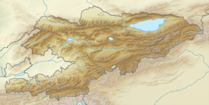
The Baybiche Too (or Baybichetoo) (Kyrgyz: Байбичетоо) is a mountain range in the central Tien-Shan separating the Middle Naryn and Atbashi valleys. The range runs 140 km along its axis with the highest elevation at 4,337 m. The range is composed of uplifted Paleozoic limestones, schists, and granites.[1]
References
This article is issued from
Wikipedia.
The text is licensed under Creative Commons - Attribution - Sharealike.
Additional terms may apply for the media files.