Bayar, Kasaragod
| Bayar | |
|---|---|
| village | |
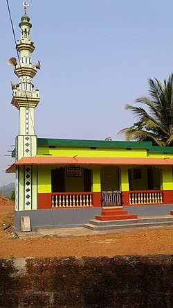 Balloor Mosque | |
 Bayar Location in Kerala, India  Bayar Bayar (India) | |
| Coordinates: 12°41′0″N 75°0′0″E / 12.68333°N 75.00000°ECoordinates: 12°41′0″N 75°0′0″E / 12.68333°N 75.00000°E | |
| Country |
|
| State | Kerala |
| District | Kasaragod |
| Government | |
| • Body | Paivalike |
| Population (2001) | |
| • Total | 10,412 |
| Languages | |
| • Official | Tulu, Malayalam |
| Time zone | UTC+5:30 (IST) |
| Vehicle registration | KL- |
Bayar is a village in Kasaragod district in the state of Kerala, India. Bayar is 12 km far from the Uppala town.[1]
Demographics
As of 2001 India census, Bayar had a population of 10412 with 5259 males and 5153 females. Bayar is about 4 km away to one of the beautiful picnic spot called Posadi Gumpe.It is situated to northeast to kasargod. It is the border of karnataka.Posadigumpe has a beautiful chill climate and a fresh air about it at all times.Read about Posadi Gumpe Here : Posadi Gumpe
Geography
This small village is entirely surrounded by many hills.
Temples
The famous temple of Bayar include "Sri Panchlingeshwara Devasthanam" and Shree Durgaparameshwari Temple Avalamutt. "Badiyaru Nemotsava" is the most famous religious festival of the village which takes place around the month of April for about a week. People celebrate Navarathri, Ganesha Chathurthi, Sri Krishna Janmashtami, Maha Shivarathri, Sharada Pooja, Badiyaru Jathre, Aayudha Pooja, Deepavali, bayar badriya juma masjid bayar jaram darga Shareef fathima masjid ponnangala Ramzan, Eid-Ul-Fitar, Pernal. The village has rich cultural talents in Yakshagana. Most beloved sport is Volleyball, Kabaddi and Cricket.
Languages
This locality is an essentially multi-lingual region. The people speak Malayalam, Kannada, Tulu, Beary bashe and Konkani. Migrant workers also speak Hindi and Tamil languages. This village is part of Manjeswaram assembly constituency which is again part of Kasaragod (Lok Sabha constituency)
Schools
- Heddari A.U.P School Bayar Muligadde
- Cheral English Medium school Bayar
- A.L.P School Bayar Perodi
- A.L.P school Avala
- Prashanthi Vidya Kendra,Bayar
- mahdanul uloom madrasa bayar
Transportation
Local roads have access to National Highway No.66 which connects to Mangalore in the north and Calicut in the south. The nearest railway station is Manjeshwar on Mangalore-Palakkad line. There is an airport at Mangalore.
Image gallery
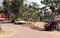 Mulighadhe
 Sinthadka
References
- ↑ "Census of India : Villages with population 5000 & above". Registrar General & Census Commissioner, India. Archived from the original on 8 December 2008. Retrieved 2008-12-10.