Baungon, Bukidnon
| Baungon | ||
|---|---|---|
| Municipality | ||
| Municipality of Baungon | ||
| ||
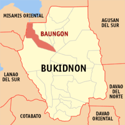 Map of Bukidnon with Baungon highlighted | ||
.svg.png) Baungon Location within the Philippines | ||
| Coordinates: 8°15′N 124°43′E / 8.25°N 124.72°ECoordinates: 8°15′N 124°43′E / 8.25°N 124.72°E | ||
| Country |
| |
| Region | Northern Mindanao (Region X) | |
| Province | Bukidnon | |
| District | 1st district of Bukidnon | |
| Barangays | 16 (see Barangays) | |
| Government [1] | ||
| • Type | Sangguniang Bayan | |
| • Mayor | Pedro R. Alvarez | |
| • Electorate | 22,342 voters (2016) | |
| Area [2] | ||
| • Total | 328.34 km2 (126.77 sq mi) | |
| Population (2015 census)[3] | ||
| • Total | 34,336 | |
| • Density | 100/km2 (270/sq mi) | |
| Time zone | UTC+8 (PST) | |
| ZIP code | 8707 | |
| PSGC | 101301000 | |
| IDD : area code | +63 (0)88 | |
| Climate type | Tropical rainforest climate | |
| Income class | 2nd municipal income class | |
| Revenue (₱) | 129,317,927.70 (2016) | |
| Native languages |
Binukid Cebuano Ata Manobo Tagalog | |
| Website |
www | |

Baungon, officially the Municipality of Baungon, is a 2nd class municipality in the province of Bukidnon, Philippines. According to the 2015 census, it has a population of 34,336 people.[3]
Geography
Baungon is located in the northern part of Bukidnon, about 132 kilometres (82 mi) north of Malaybalay City via Cagayan de Oro, which is about 30 kilometres (19 mi) from Imbatug, the town's poblacion. It is bounded on the north-east by the Libona, at the south by the Lantapan, and on the west by Talakag. It has a land area of 328.34 square kilometres based on the cadastral survey made by the DENR.
Climate
Typical of the province environmental condition, Baungon belongs to the third type of climate which is relatively dry from March to April and wet from May to December. In 1997, the heaviest rainfall was recorded in January with 497.8 millimetres (19.60 in). April has the lowest amount of rainfall with 24.3 millimetres (0.96 in). The average temperature is 25 °C (77 °F) and the average humidity is 82.2%.
Topography
The bigger part of Baungon is located over plateau, the terrain of which is generally flat with slowly rising mountains and some canyons with a highest slope of 30%. In some parts, however, the terrain is strongly sloping to severely eroded. It has three (3) large rivers, namely; Bobonawan in the north, Tumalaong at the south, and Kalawaig at the west. These rivers and its tributaries serve as natural drainage system.
Near the airport, one can find Kabula River, a favorite site for water rafting.
Flora
Baungon is home to two of the world's rarest flowers: Rafflesia and Amorphophallus paeoniifolius. The Rafflesia that grows in Baungon was identified by one botanist, Ulysses Ferreras, as Rafflesia schadenbergiana, which was thought to be extinct. Such Rafflesia was last seen by the German Alex Schandenberg on Mount Apo in the year 1881, but found again in Bukidnon after 126 years.[4] This Rafflesia is called by locals as "Kolon Busaw" and grows well in its soil.[5]
Barangays
Baungon is politically subdivided into 16 barangays.
| PSGC | Barangay | Population | ±% p.a. | |||
|---|---|---|---|---|---|---|
| 2015[3] | 2010[6] | |||||
| 101301001 | Balintad | 1.6% | 539 | 660 | −3.78% | |
| 101301002 | Buenavista | 2.7% | 916 | 1,072 | −2.95% | |
| 101301003 | Danatag | 7.5% | 2,561 | 2,585 | −0.18% | |
| 101301004 | Kalilangan | 2.0% | 680 | 883 | −4.85% | |
| 101301005 | Lacolac | 1.8% | 608 | 685 | −2.24% | |
| 101301006 | Langaon | 3.2% | 1,087 | 1,044 | 0.77% | |
| 101301007 | Liboran | 9.8% | 3,358 | 3,094 | 1.57% | |
| 101301008 | Lingating | 12.2% | 4,175 | 4,726 | −2.33% | |
| 101301009 | Mabuhay | 4.5% | 1,529 | 1,628 | −1.19% | |
| 101301010 | Mabunga | 3.7% | 1,272 | 1,162 | 1.74% | |
| 101301011 | Nicdao | 6.3% | 2,159 | 1,938 | 2.08% | |
| 101301012 | Imbatug (Poblacion) | 18.5% | 6,363 | 5,231 | 3.80% | |
| 101301013 | Pualas | 7.4% | 2,524 | 2,065 | 3.90% | |
| 101301014 | Salimbalan | 9.3% | 3,189 | 2,915 | 1.73% | |
| 101301015 | San Vicente | 6.8% | 2,344 | 2,143 | 1.72% | |
| 101301016 | San Miguel | 3.0% | 1,032 | 1,037 | −0.09% | |
| Total | 34,336 | 32,868 | 0.84% | |||
Demographics

| Population census of Baungon | ||
|---|---|---|
| Year | Pop. | ±% p.a. |
| 1918 | 727 | — |
| 1939 | 2,345 | +5.74% |
| 1948 | 3,927 | +5.90% |
| 1960 | 7,617 | +5.68% |
| 1970 | 11,251 | +3.97% |
| 1975 | 14,974 | +5.90% |
| 1980 | 18,320 | +4.11% |
| 1990 | 19,774 | +0.77% |
| 1995 | 22,617 | +2.55% |
| 2000 | 26,695 | +3.62% |
| 2007 | 29,757 | +1.51% |
| 2010 | 32,868 | +3.68% |
| 2015 | 34,336 | +0.84% |
| Source: Philippine Statistics Authority[3] [6] [7] [8] | ||
In the 2015 census, the population of Baungon was 34,336 people,[3]
with a density of 100 inhabitants per square kilometre or 260 inhabitants per square mile.
Economy
The town's economy is primarily agricultural. The main agricultural products of Baungon are corn, casava, banana, camote, fruits and vegetables, bamboo crafts, and abaca products. Mill products consist of the following: corn grits, rice, and casava starch.
References
- ↑ "Municipality". Quezon City, Philippines: Department of the Interior and Local Government. Retrieved 31 May 2013.
- ↑ "Province: Bukidnon". PSGC Interactive. Quezon City, Philippines: Philippine Statistics Authority. Retrieved 12 November 2016.
- 1 2 3 4 5 Census of Population (2015). "Region X (Northern Mindanao)". Total Population by Province, City, Municipality and Barangay. PSA. Retrieved 20 June 2016.
- ↑ Lays, P. (2006). Rediscovery of a floral jewel in the Philippine archipelago: Rafflesia schadenbergiana Göppert, 1885 (Rafflesiaceae). Lejeunia 182: 1–16.
- ↑ Barcelona, J. F.; P. B Pelser; D. S. Balete; L. L. Co (October 2009). "Taxonomy, ecology, and conservation status of Philippine Rafflesia (Rafflesiaceae)". Blumea. 54: 77–94. doi:10.3767/000651909X474122.
- 1 2 Census of Population and Housing (2010). "Region X (Northern Mindanao)". Total Population by Province, City, Municipality and Barangay. NSO. Retrieved 29 June 2016.
- ↑ Censuses of Population (1903–2007). "Region X (Northern Mindanao)". Table 1. Population Enumerated in Various Censuses by Province/Highly Urbanized City: 1903 to 2007. NSO.
- ↑ "Province of Bukidnon". Municipality Population Data. Local Water Utilities Administration Research Division. Retrieved 17 December 2016.
External links
Places adjacent to Baungon, Bukidnon | ||||||||||
|---|---|---|---|---|---|---|---|---|---|---|
| ||||||||||