Mount Batutara
| Batu Tara alias Komba | |
|---|---|
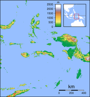
 Batu Tara and the Lesser Sunda Islands as seen from the NASA MODIS satellite. | |
| Highest point | |
| Elevation | 748 m (2,454 ft) [1] |
| Coordinates | 7°47′31″S 123°34′44″E / 7.792°S 123.579°ECoordinates: 7°47′31″S 123°34′44″E / 7.792°S 123.579°E |
| Geography | |
 Batu Tara alias Komba Batu Tara | |
| Location | East Nusa Tenggara, Indonesia |
| Geology | |
| Age of rock | Holocene |
| Mountain type | Stratovolcano |
| Last eruption | 2007 to 2015 (ongoing) |
Batu Tara stratovolcano is a volcano located on the small isolated Komba island in the Flores Sea in Indonesia. Vegetations covers the flanks of Batu Tara. The first historical eruption occurred in 1852 with explosions and lava flows.[1]
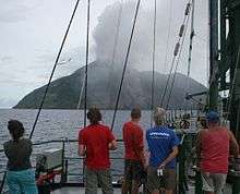
Batu Tara eruption, photo courtesy Mike Mate
See also
References
- 1 2 "Batu Tara". Global Volcanism Program. Smithsonian Institution. Retrieved 2006-12-28.
This article is issued from
Wikipedia.
The text is licensed under Creative Commons - Attribution - Sharealike.
Additional terms may apply for the media files.