Batham Gate
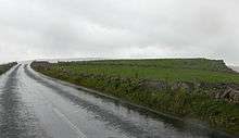
Batham Gate is the medieval name for a Roman road in Derbyshire, England, which ran south-west from Templebrough on the River Don to Brough-on-Noe (Latin Navio) and the spa town of Buxton (Latin Aquae Arnemetiae). Gate means "road" in northern English dialects; the name therefore means "road to the bath town".
The route of the road from Templebrough to the Roman signal station Navio is disputed. Hunter suggested the Long Causeway at Redmires as the route and it was shown as such on Ordnance Survey maps, but this is now known to be a medieval packhorse saltway.[1]
Roman road historian Ivan Donald Margary said that the Long Causeway had a slightly different route in Roman times. In his book Roman Roads In Britain he said that evidence is now available that shows that after the Redmires Reservoir the Roman road did not follow the medieval route to Stanedge Pole but kept to the line of the present-day track to Stanedge Lodge. The Roman road then descended Stanage Edge half a mile north-west of the present route, on a narrow and steeper terrace.[2]
Another possible route, backed by excavations carried out in 2016, suggests a route that would have taken the road close to the Roman villa at Whirlow Hall Farm. An interim report by University of Sheffield staff on excavations of a linear feature in the Sheephill Road area of Ringinglow has suggested this as the route of the lost Roman road. The feature, which extends through Barber Fields, is 20m wide and filled to a depth of 5m with rubble and has a metalled surface.[3]
References
- ↑ "Long Causway Management Plan" (PDF). Peak District National Park. Retrieved 3 December 2017.
- ↑ Dodd, A.E.; Dodd, E.M. Peakland Roads and Trackways. Moorland Publishing Co. p. 38. ISBN 0 86190 004 9. Gives details of Roman deviation.
- ↑ Inglis, D. H. (January 2016). "The Roman Road Project" (PDF). Roman Roads Research Association. Retrieved 4 December 2017.
External links
- About Batham Gate
- Ordnance survey Map showing Batham Gate near Brough
- Geograph image of Batham Gate Roman road, near Peak Forest