Batagay-Alyta
| Batagay-Alyta Батагай-Алыта (Russian) Баатаҕай Алыыта (Yakut) | |
|---|---|
|
- Rural locality[1] - Selo[1] | |
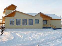 Airport Terminal | |
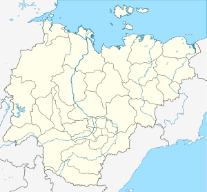
_Republic_(2008-03).svg.png) Location of the Sakha (Yakutia) Republic in Russia | |
 Batagay-Alyta | |
| Administrative status (as of June 2009) | |
| Country | Russia |
| Federal subject | Sakha Republic[1] |
| Administrative district | Eveno-Bytantaysky National District[1] |
| Rural okrug | Tyugesirsky Rural Okrug[1] |
| Administrative center of | Eveno-Bytantaysky National District,[1] Tyugesirsky Rural Okrug[1] |
| Municipal status (as of April 2012) | |
| Municipal district | Eveno-Bytantaysky Municipal District[2] |
| Rural settlement | Tyugesirsky Rural Settlement[2] |
| Administrative center of | Eveno-Bytantaysky Municipal District,[2] Tyugesirsky Rural Settlement[2] |
| Statistics | |
| Population (2010 Census) | 1,832 inhabitants[3] |
| Time zone | YAKT (UTC+09:00)[4] |
| Founded | 1936 |
| Postal code(s)[5] | 678580 |
| Batagay-Alyta on Wikimedia Commons | |
Batagay-Alyta (Russian: Батагай-Алыта; Sakha: Баатаҕай Алыыта, Baatağay Alııta, IPA: [baːtaʁaj alɯːta]), also known as Sakkyryr (Russian: Саккырыр; Sakha: Саккырыыр, Saqqırıır, IPA: [saqqɯɾɯːɾ]) is a rural locality (a selo) and the administrative center of Eveno-Bytantaysky National District in the Sakha Republic, Russia, located on the eastern flank of the Verkhoyansk Range, a few kilometers from the left bank of the Ulakhan-Sakkyryr River. Its population as of the 2010 Census was 1,832.[3]
History
It was founded in 1936 as the administrative center for the then newly created Sakkyryrsky District. It lost this function with the dissolution of the district in 1963, but regained it with the creation of Eveno-Bytantaysky District in 1989.
Demographics
Population: 1,832 (2010 Census);[3] 1,722 (2002 Census).[6]
The population includes a large proportion of Evens, with the Even language taught in the local school.
Transportation
Batagay-Alyta is served by the Sakkyryr Airport (IATA: SUK). There are no year-round roads connecting to Batagay-Alyta, although a winter road offers a route east to Verkhoyansk and Batagay when the rivers are frozen.
Climate
| Climate data for Batagay-Alyta | |||||||||||||
|---|---|---|---|---|---|---|---|---|---|---|---|---|---|
| Month | Jan | Feb | Mar | Apr | May | Jun | Jul | Aug | Sep | Oct | Nov | Dec | Year |
| Average high °C (°F) | −43.3 (−45.9) |
−38.7 (−37.7) |
−18.8 (−1.8) |
−3.1 (26.4) |
9.7 (49.5) |
18.9 (66) |
22.6 (72.7) |
18.7 (65.7) |
7.6 (45.7) |
−10.2 (13.6) |
−30.8 (−23.4) |
−41.4 (−42.5) |
−9.1 (15.7) |
| Average low °C (°F) | −46.9 (−52.4) |
−46.6 (−51.9) |
−37.0 (−34.6) |
−21.0 (−5.8) |
−1.8 (28.8) |
7.6 (45.7) |
10.9 (51.6) |
6.2 (43.2) |
−1.8 (28.8) |
−18.1 (−0.6) |
−36.1 (−33) |
−45.0 (−49) |
−19.1 (−2.4) |
| Average precipitation mm (inches) | 5.9 (0.232) |
6.2 (0.244) |
5.6 (0.22) |
3.4 (0.134) |
15.3 (0.602) |
32.4 (1.276) |
27.1 (1.067) |
26.1 (1.028) |
16.8 (0.661) |
8.9 (0.35) |
10.0 (0.394) |
6.0 (0.236) |
163.7 (6.444) |
| Average precipitation days | 8 | 7 | 5 | 3 | 6 | 10 | 10 | 10 | 7 | 7 | 8 | 6 | 87 |
| Source #1: https://web.archive.org/web/20131006193245/http://www.storm247.com/weather/118964226/climate (temperature) | |||||||||||||
| Source #2: http://www.worldweatheronline.com/Batagay-Alyta-weather-averages/Sakha/RU.aspx (precipitation) | |||||||||||||
References
Notes
- 1 2 3 4 5 6 7 Registry of the Administrative-Territorial Divisions of the Sakha Republic
- 1 2 3 4 Law #173-Z 353-III
- 1 2 3 Russian Federal State Statistics Service (2011). "Всероссийская перепись населения 2010 года. Том 1" [2010 All-Russian Population Census, vol. 1]. Всероссийская перепись населения 2010 года (2010 All-Russia Population Census) (in Russian). Federal State Statistics Service. Retrieved June 29, 2012.
- ↑ Правительство Российской Федерации. Федеральный закон №107-ФЗ от 3 июня 2011 г. «Об исчислении времени», в ред. Федерального закона №271-ФЗ от 03 июля 2016 г. «О внесении изменений в Федеральный закон "Об исчислении времени"». Вступил в силу по истечении шестидесяти дней после дня официального опубликования (6 августа 2011 г.). Опубликован: "Российская газета", №120, 6 июня 2011 г. (Government of the Russian Federation. Federal Law #107-FZ of June 31, 2011 On Calculating Time, as amended by the Federal Law #271-FZ of July 03, 2016 On Amending Federal Law "On Calculating Time". Effective as of after sixty days following the day of the official publication.).
- ↑ Почта России. Информационно-вычислительный центр ОАСУ РПО. (Russian Post). Поиск объектов почтовой связи (Postal Objects Search) (in Russian)
- ↑ Russian Federal State Statistics Service (May 21, 2004). "Численность населения России, субъектов Российской Федерации в составе федеральных округов, районов, городских поселений, сельских населённых пунктов – районных центров и сельских населённых пунктов с населением 3 тысячи и более человек" [Population of Russia, Its Federal Districts, Federal Subjects, Districts, Urban Localities, Rural Localities—Administrative Centers, and Rural Localities with Population of Over 3,000] (XLS). Всероссийская перепись населения 2002 года [All-Russia Population Census of 2002] (in Russian). Retrieved August 9, 2014.
Sources
- Official website of the Sakha Republic. Registry of the Administrative-Territorial Divisions of the Sakha Republic. Eveno-Bytantaysky National District. (in Russian)
- Государственное Собрание (Ил Тумэн) Республики Саха (Якутия). Закон №173-З №353-III от 30 ноября 2004 г. «Об установлении границ и о наделении статусом городского и сельского поселений муниципальных образований Республики Саха (Якутия)», в ред. Закона №1058-З №1007-IV от 25 апреля 2012 г. «О внесении изменений в Закон Республики Саха (Якутия) "Об установлении границ и о наделении статусом городского и сельского поселений муниципальных образований Республики Саха (Якутия)"». Вступил в силу со дня официального опубликования. Опубликован: "Якутия", №245, 31 декабря 2004 г. (State Assembly (Il Tumen) of the Sakha (Yakutia) Republic. Law #173-Z No. 353-III of November 30, 2004 On Establishing the Borders and on Granting the Urban and Rural Settlement Status to the Municipal Formations of the Sakha (Yakutia) Republic, as amended by the Law #1058-Z No. 1007-IV of April 25, 2012 On Amending the Law of the Sakha (Yakutia) Republic "On Establishing the Borders and on Granting the Urban and Rural Settlement Status to the Municipal Formations of the Sakha (Yakutia) Republic". Effective as of the day of the official publication.).