Barnardsville, North Carolina
| Barnardsville | |
|---|---|
| Unincorporated community | |
.jpg) Barnardsville, circa 1921 | |
 Barnardsville Location within the state of North Carolina  Barnardsville Barnardsville (the US) | |
| Coordinates: 35°46′39″N 82°27′17″W / 35.77750°N 82.45472°WCoordinates: 35°46′39″N 82°27′17″W / 35.77750°N 82.45472°W | |
| Country | United States |
| State | North Carolina |
| County | Buncombe |
| Elevation | 2,201 ft (671 m) |
| Time zone | UTC-5 (Eastern (EST)) |
| • Summer (DST) | UTC-4 (EDT) |
| GNIS feature ID | 1018968[1] |
Barnardsville is an unincorporated community in Buncombe County, North Carolina, United States.[1]
Located on Ivy Creek, the settlement is part of the Asheville Metropolitan Statistical Area.
History
Barnard's Inn was established at the settlement by Hezekiah and Hester Barnard in the early 1800s.[2]
A post office was established in 1875.[3]
Barnardsville incorporated in 1959, and established its own police force and fire department. The town dissolved its incorporation in 1965 for financial reasons.[3][4]
Located at the settlement is an elementary school, a restaurant, a post office, many churches, and the Big Ivy Community Center, where Mountain Heritage Day is celebrated on the first Saturday of October. Access to the scenic Blue Ridge Parkway is available through Barnardsville.
References
- 1 2 U.S. Geological Survey Geographic Names Information System: Barnardsville
- ↑ Ruscin, Terry (2016). A History of Transportation in Western North Carolina: Trails, Roads, Rails and Air. Arcadia.
- 1 2 Powell, William S.; Hill, Michael (2010). The North Carolina Gazetteer, Second Edition. University of North Carolina Press. p. 25.
- ↑ Lawrence, Brian (2014). Firefighting in Buncombe County. Arcadia. p. 31.
Municipalities and communities of Buncombe County, North Carolina, United States | ||
|---|---|---|
| City | 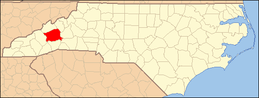 | |
| Towns | ||
| CDPs | ||
| Unincorporated communities | ||