Bapen Township
| Bapen 岜盆乡 | |
|---|---|
| Township | |
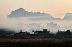 Dawn in Bapen Township | |
| Coordinates: 22°31′25″N 107°51′51″E / 22.52361°N 107.86417°ECoordinates: 22°31′25″N 107°51′51″E / 22.52361°N 107.86417°E | |
| Country | People's Republic of China |
| Region | Guangxi |
| Prefecture-level city | Chongzuo |
| County | Fusui |
| Village-level divisions | 8 villages |
| Area | |
| • Total | 152 km2 (59 sq mi) |
| Population (2011) | |
| • Total | 27,552 |
| • Density | 180/km2 (470/sq mi) |
| Time zone | UTC+8 (China Standard) |
| Postal code | 532102 |
Bapen (simplified Chinese: 岜盆乡; traditional Chinese: 岜盆鄉; pinyin: Bāpén Xiāng; zhuang: Bahbwnz Yangh) is a Township under the administration of Fusui County in southern Guangxi Zhuang Autonomous Region, China.[1] As of 2011, it had an area of 152 square kilometres (59 sq mi) populated by 27,552 people residing in 8 villages.[2]
Administrative divisions
There are 8 villages:[3]
Villages:
- Napo(那坡村), Gudou(姑豆村), Nabiao(弄廪村),Balun(岜伦村), Nongdong(弄洞村), Tuoliao(驮辽村), Nabiao(那标村), Bapen(岜盆村)
See also
References
- ↑ 2011年统计用区划代码和城乡划分代码:扶绥县 (in Chinese). National Bureau of Statistics of the People's Republic of China. Archived from the original on 2012-07-21. Retrieved 2013-01-08.
- ↑ 2011年统计用区划代码和城乡划分代码:岜盆乡 (in Chinese). National Bureau of Statistics of the People's Republic of China. Retrieved 2013-01-03.
- ↑ 2011年统计用区划代码和城乡划分代码:岜盆乡 中华人民共和国国家统计局 National Bureau of Statistics of the People's Republic of China. Retrieved 2013-01-02.(in Chinese)
External links
- Bapen Township/Official website of Bapen(in Chinese)
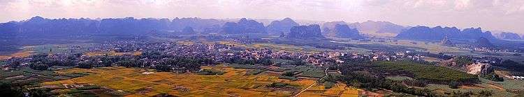
Panorama view in Bapen Township
This article is issued from
Wikipedia.
The text is licensed under Creative Commons - Attribution - Sharealike.
Additional terms may apply for the media files.