Bannwaldsee
| Bannwaldsee | |
|---|---|
 | |
| Location | Allgäu, Bavaria |
| Coordinates | 47°36′4″N 10°46′38″E / 47.60111°N 10.77722°ECoordinates: 47°36′4″N 10°46′38″E / 47.60111°N 10.77722°E |
| Primary inflows | Buchinger Ache |
| Primary outflows | Mühlberger Ach |
| Catchment area | 21.42 km2 (8.27 sq mi) |
| Basin countries | Germany |
| Max. length | 2.34 km (1.45 mi) |
| Max. width | 1.445 km (0.898 mi) |
| Surface area | 2.28 km2 (0.88 sq mi) |
| Average depth | 6.2 m (20 ft) |
| Max. depth | 12 m (39 ft) |
| Water volume | 14,090,000 m3 (498,000,000 cu ft) |
| Residence time | 5.2 years |
| Shore length1 | 6.79 km (4.22 mi) |
| Surface elevation | 785.9 m (2,578 ft) |
| 1 Shore length is not a well-defined measure. | |
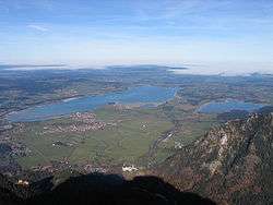
Bannwaldsee is a lake in Allgäu, Bavaria, Germany. At an elevation of 785.9 m, its surface area is 2.28 km².
External links
- Nixdorf, B.; et al. (2004), "Bannwaldsee", Dokumentation von Zustand und Entwicklung der wichtigsten Seen Deutschlands (in German), Berlin: Umweltbundesamt, p. 13
This article is issued from
Wikipedia.
The text is licensed under Creative Commons - Attribution - Sharealike.
Additional terms may apply for the media files.