Bankouale
| Bankouale بنكوالي | |
|---|---|
| Town | |
 | |
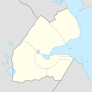 Bankouale بنكوالي Location in Djibouti | |
| Coordinates: 11°49′N 42°40′E / 11.817°N 42.667°E | |
| Country |
|
| Region | Tadjoura |
| Elevation | 640 m (2,100 ft) |
Bankouale (Arabic: بنكوالي) is a town in Tadjoura region of Djibouti. One of the distinctive features of Bankouale countryside is the widespread growing of vegetables.
Climate
Bankouale has a hot semi-arid climate (BSh) in Köppen-Geiger system.
| Climate data for Tadjoura | |||||||||||||
|---|---|---|---|---|---|---|---|---|---|---|---|---|---|
| Month | Jan | Feb | Mar | Apr | May | Jun | Jul | Aug | Sep | Oct | Nov | Dec | Year |
| Average high °C (°F) | 25.0 (77) |
25.2 (77.4) |
27.2 (81) |
29.4 (84.9) |
32.9 (91.2) |
36.5 (97.7) |
36.9 (98.4) |
35.9 (96.6) |
34.0 (93.2) |
30.1 (86.2) |
27.2 (81) |
25.5 (77.9) |
30.5 (86.9) |
| Average low °C (°F) | 16.0 (60.8) |
17.0 (62.6) |
18.3 (64.9) |
20.5 (68.9) |
23.2 (73.8) |
26.5 (79.7) |
25.6 (78.1) |
25.0 (77) |
25.0 (77) |
20.6 (69.1) |
18.1 (64.6) |
16.7 (62.1) |
21 (69.9) |
| Average precipitation mm (inches) | 30 (1.18) |
27 (1.06) |
18 (0.71) |
23 (0.91) |
10 (0.39) |
4 (0.16) |
16 (0.63) |
28 (1.1) |
26 (1.02) |
11 (0.43) |
34 (1.34) |
23 (0.91) |
250 (9.84) |
| Source: Climate-Data.org, altitude: 640m[1] | |||||||||||||
References
- ↑ "Climate: Bankouale - Climate graph, Temperature graph, Climate table". Climate-Data.org. Retrieved 6 September 2017.
External links
This article is issued from
Wikipedia.
The text is licensed under Creative Commons - Attribution - Sharealike.
Additional terms may apply for the media files.