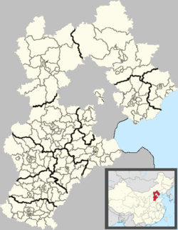
Bailuquan Township
| Bailuquan Township 白鹿泉乡 | |
|---|---|
| Township | |
 Bailuquan Township Location in Hebei | |
| Coordinates: 38°04′14″N 114°16′57″E / 38.07056°N 114.28250°ECoordinates: 38°04′14″N 114°16′57″E / 38.07056°N 114.28250°E | |
| Country | People's Republic of China |
| Province | Hebei |
| Prefecture-level city | Shijiazhuang |
| County-level city | Luquan |
| Village-level divisions | 17 villages |
| Area | |
| • Total | 41.86 km2 (16.16 sq mi) |
| Elevation | 140 m (460 ft) |
| Population (2004) | |
| • Total | 9,169 |
| Time zone | UTC+8 (China Standard) |
| Area code(s) | 0311 |
Bailuquan (Chinese: 白鹿泉; pinyin: Báilùquán) is a township under the administration of Luquan City in southwestern Hebei province, China.[1]
The township is located just to the southwest of Luquan and 23 kilometres (14 mi) by road west of Shijiazhuang in the eastern foothills of the Taihang Mountains.[2]
The township covers an area of 41.86 square kilometres (16.16 sq mi) and had a population of 9169 in 2004.[1]
Administrative divisions
The township contains the following villages:[3]
- Dongtumen Village (东土门村委会)
- Xitumen Village (西土门村委会)
- Qiezhuang Village (郄庄村委会)
- Zaolin Village (枣林村委会)
- Caofang Village (曹坊村委会)
- Bailuquan Village (白鹿泉村委会)
- Donghushen Village (东胡申村委会)
- Xihushen Village (西胡申村委会)
- Gujiayu Village (谷家峪村委会)
- Xixuezhuang Village (西薛庄村委会)
- Xiyangzhuang Village (西杨庄村委会)
- Duanzhuang Village (段庄村委会)
- Shuiyu Village (水峪村委会)
- Shangniezhuang Village (上聂庄村委会)
- Helianyu Village (荷莲峪村委会)
- Wuzhuang Village (武庄村委会)
- Liangzhuang Village (粱庄村委会)
See also
References
- 1 2 白鹿泉乡 (in Chinese). xzqh.org. Archived from the original on 23 September 2011. Retrieved 18 August 2011.
- ↑ Maps (Map). Google Maps.
- ↑ "Bailuquan Township". CC Guide. Archived from the original on 23 July 2012. Retrieved 26 May 2012.
This article is issued from
Wikipedia.
The text is licensed under Creative Commons - Attribution - Sharealike.
Additional terms may apply for the media files.