Bandikot
| Bandikot बाँदीकोट | |
|---|---|
| Village Development Committee | |
 Bandikot | |
| Coordinates: 28°09′N 83°02′E / 28.15°N 83.03°E | |
| Country |
|
| Region | Mid-Western |
| Zone | Rapti Zone |
| District | Pyuthan District |
| VDC | Bandikot |
| Population (2001 Census[1]) | |
| • Total | 4,426 |
| 834 households | |
| Time zone | UTC+5:45 (Nepal Time) |
| Postal Code: | |
Bandikot is a town and Village Development Committee in Pyuthan, a Middle Hills district of Rapti Zone, western Nepal. Bandikot also refers to a historic fortress. This is the home place of Mr. Pit Bahadur Mahatara, Central Committee Member (CCM) of The Communist Party of Nepal (Maoist-Centre) (Nepali: नेपाल कम्युनिष्ट पार्टी (माओवादी-केन्द्र), or CPN (M-C). [2]
Villages in VDC
| Ward | Lat. | Lon | Elev. | ||
|---|---|---|---|---|---|
| Agara | अगारा | 5 | 28°09'N | 83°01'E | 1,325m |
| Ahalkholagaun | आहालखोलागाउँ | 1 | 28°10'N | 83°00'E | 1,155 |
| Badachaur | बडाचौर | 8 | 28°08'N | 83°03'E | 1,561 |
| Baghmara | बाघमारा | 8 | 28°08'N | 83°03'E | 1,260 |
| Bakhrikhor | बाख्रिखोर | 3 | 28°09'N | 83°00'E | 1,415 |
| Baluwa | बालुवा | 8 | 28°08'N | 83°03'E | 1,290 |
| Bandikot | बाँदीकोट | 28°09'N | 83°00'E | 1,639 | |
| Baskholagaun | बासखोलागाउँ | 28°07'N | 83°00'E | 1,038 | |
| Betane | बेताने | 9 | 28°08'N | 83°02'E | 1,359 |
| Bhaterchaur | भतेरचौर | 4 | 28°09'N | 83°01'E | 1,535 |
| Chiphleti | चिफ्लेटी | 6 | 28°09'N | 83°02'E | 1,610 |
| Dadra | दाद्रा | 8 | 28°08'N | 83°03'E | 1,355 |
| Dandakharka | डाँडाखर्क | 9 | 28°08'N | 83°02'E | 1,434 |
| Deurali | देउराली | 7 | 28°09'N | 83°02'E | 1,795 |
| Dhaireni | धैरेनी | 28°08'N | 83°00'E | 1,442 | |
| Dhake Dihi | ढाके डिही | 1 | 28°09'N | 83°01'E | 1,215 |
| Dhodra | धोद्रा | 6 | 28°09'N | 83°02'E | 1,565 |
| Dummare | डुम्मारे | 28°08'N | 83°03'E | 1,462 | |
| Duwachaur | दुवाचौर | 9 | 28°08'N | 83°01'E | 1,511 |
| Gaderpani | गडेरपानी | 4 | 28°09'N | 83°01'E | 1,210 |
| Gatina | गातिना | 9 | 28°07'N | 83°01'E | 1,110 |
| Halte | हल्ते | 1 | 28°09'N | 83°01'E | 1,165 |
| Kandapani | काँडापानी | 4 | 28°09'N | 83°01'E | 1,650 |
| Kansi Pokhara | काँसी पोखरा | 5 | 28°09'N | 83°01'E | 1,595 |
| Kaule | काउले | 6 | 28°09'N | 83°02'E | 1,465 |
| Khorpani | खोरपानी | 4 | 28°08'N | 83°00'E | 1,410 |
| Kotphera | कोटफेरा | 2 | 28°09'N | 83°00'E | 1,595 |
| Maidan | मैदान | 3 | 28°09'N | 83°01'E | 1,510 |
| Malya | मल्या | 28°10'N | 83°02'E | 1,650 | |
| Mathillo Sihanla | माथिल्लो सिहाँला | 1 | 28°10'N | 83°01'E | 1,645 |
| Mulapani Chormare | मूलापानी चोरमारे | 7 | 28°10'N | 83°02'E | 1,782 |
| Pale | पाले | 28°08'N | 83°04'E | 1,692 | |
| Silinge | सिलिङ्गे | 5 | 28°09'N | 83°01'E | 1,522 |
| Simleni | सिम्लेनी | 2 | 28°09'N | 83°00'E | 1,250 |
| Tallo Sihanla | तल्लो सिहाँला | 1 | 28°10'N | 83°01'E | 1,450 |
| Thapchaur | थापचौर | 5 | 28°09'N | 83°01'E | 1,290 |
| Timurkharka | टिमुरखर्क | 28°08'N | 83°03'E | 1,505 |
References
- ↑ "Nepal Census 2001". Nepal's Village Development Committees. Digital Himalaya. Archived from the original on 12 October 2008. Retrieved 21 September 2008.
- ↑ Bhandari, Bishnu, ed. (1997). Inventory of heritage sites in Nepal. Kathmandu: IUCN Nepal. Retrieved 15 April 2011.
- ↑ "Index of Geographical Names of Nepal, Volume IV: Mid Western Development Region, List of Settlements, Pyuthan" (PDF). Government of Nepal, National Geographic Information Infrastructure Program. Archived from the original (PDF) on 24 July 2011. Retrieved 12 March 2011.
External links
Bandikot
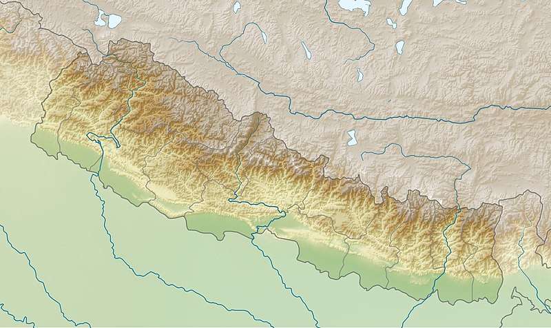
Location of Bandikot VDC, Pyuthan District, Rapti Zone
This article is issued from
Wikipedia.
The text is licensed under Creative Commons - Attribution - Sharealike.
Additional terms may apply for the media files.