Badda Thana
| Badda বাড্ডা | |
|---|---|
| Thana | |
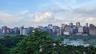
 Badda Location in Dhaka | |
| Coordinates: 23°47.2′N 90°25.5′E / 23.7867°N 90.4250°ECoordinates: 23°47.2′N 90°25.5′E / 23.7867°N 90.4250°E | |
| Country |
|
| Division | Dhaka Division |
| District | Dhaka District |
| Area | |
| • Total | 16.78 km2 (6.48 sq mi) |
| Elevation[1] | 23 m (75 ft) |
| Population (1991) | |
| • Total | 157,924 |
| • Density | 9,411/km2 (24,370/sq mi) |
| Time zone | UTC+6 (BST) |
| Website | Official Map of the Badda Thana |
Badda (Bengali: বাড্ডা) is a Thana of Dhaka District in the Division of Dhaka, Bangladesh. It was formed from parts in December 1998 from parts of Cantonment Thana and Gulshan Thana.[2] Badda is adjacent to Rampura, Gulshan and Bari Dhara thana.
Geography
Badda is located at 23°47′10″N 90°25′30″E / 23.786111°N 90.425°E. Its total area is 16.78 km²
Demographics
This Badda has a population of 157924. Males constitute 55.68% of the population, and females 44.32%. Badda has an average literacy rate of 58.5%, and the national average of 32.4% literate.
Administration
Badda has 2+4 Unions/Wards, 16+14 Mauzas/Mahallas, and 0 villages.
Suburbs That Falls under Badda Thana
- Banasree
- North Badda
- Middle Badda
- South Badda
- Merul Badda
- Badda DIT Project
- Shahzadpur
- Aftabnagar
- Nurerchala
- Satarkul & Barid
Education
According to Banglapedia, Badda Alatunnessa Higher Secondary School, Satarkul High school, and Cambrian School and College, founded 2004, are notable higher secondary schools.[2] Badda thana has dozens of private kinder garden schools, few law schools, and several government primary schools.
See also
References
- ↑ "Geographic coordinates of Dhaka, Bangladesh". DATEANDTIME.INFO. Retrieved 7 July 2016.
- 1 2 Molla, Md Tuhin (2012). "Badda Thana". In Islam, Sirajul; Jamal, Ahmed A. Banglapedia: National Encyclopedia of Bangladesh (Second ed.). Asiatic Society of Bangladesh.