Bad Häring
| Bad Häring | ||
|---|---|---|
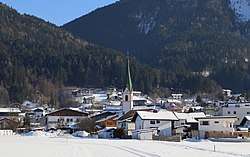 Bad Häring in winter | ||
| ||
 Bad Häring Location within Austria
Location within Kufstein district
| ||
| Coordinates: 47°30′45″N 12°07′25″E / 47.51250°N 12.12361°ECoordinates: 47°30′45″N 12°07′25″E / 47.51250°N 12.12361°E | ||
| Country | Austria | |
| State | Tyrol | |
| District | Kufstein | |
| Government | ||
| • Mayor | Hermann Ritzer (SPÖ) | |
| Area | ||
| • Total | 9.28 km2 (3.58 sq mi) | |
| Elevation | 650 m (2,130 ft) | |
| Population (1 January 2016)[1] | ||
| • Total | 2,613 | |
| • Density | 280/km2 (730/sq mi) | |
| Time zone | UTC+1 (CET) | |
| • Summer (DST) | UTC+2 (CEST) | |
| Postal code | 6323 | |
| Area code | 05332 | |
| Vehicle registration | KU | |
| Website |
www.riskommunal.at/ badhaering | |


Bad Häring is a municipality in the Kufstein district in the Austrian state of Tyrol located 4.30 km northwest of Wörgl and 9 km south of Kufstein. A strong sulfur source was found in 1951 resulting in foundation of health tourism. In 1996 the location was named the "first air spa of Tyrol“.
Population
| Historical population | ||
|---|---|---|
| Year | Pop. | ±% |
| 1869 | 740 | — |
| 1880 | 1,043 | +40.9% |
| 1890 | 1,080 | +3.5% |
| 1900 | 1,470 | +36.1% |
| 1910 | 1,709 | +16.3% |
| 1923 | 1,772 | +3.7% |
| 1934 | 1,774 | +0.1% |
| 1939 | 1,656 | −6.7% |
| 1951 | 1,814 | +9.5% |
| 1961 | 1,807 | −0.4% |
| 1971 | 1,922 | +6.4% |
| 1981 | 2,065 | +7.4% |
| 1991 | 2,197 | +6.4% |
| 2001 | 2,265 | +3.1% |
| 2013 | 2,562 | +13.1% |
References
External links
| Wikimedia Commons has media related to Bad Häring. |
This article is issued from
Wikipedia.
The text is licensed under Creative Commons - Attribution - Sharealike.
Additional terms may apply for the media files.