Azergues
| Azergues | |
|---|---|
 | |
| Country | France |
| Physical characteristics | |
| River mouth |
Saône 45°56′30″N 4°43′45″E / 45.94167°N 4.72917°ECoordinates: 45°56′30″N 4°43′45″E / 45.94167°N 4.72917°E |
| Length | 61 km (38 mi) |
| Basin features | |
| Progression | Saône→ Rhône→ Mediterranean Sea |
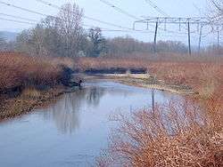
The Azergues is a river in the Rhône department, in eastern France. It is a right tributary of the Saône, which it joins in Anse. Its source is in the Beaujolais hills, near Chénelette. The Azergues flows through the following towns: Lamure-sur-Azergues,[1] Le Bois-d'Oingt, Chessy, Châtillon, Chazay-d'Azergues and Anse.[2]
Etymology
The name Azergues comes from the Arabic "Azrek" (أزرق), which means blue.[3]
References
- ↑ "Le portail des territoires et des citoyens - Géoportail". Geoportail.fr. Retrieved 2013-02-09.
- ↑
- ↑ http://www.guichetdusavoir.org/viewtopic.php?t=26073
This article is issued from
Wikipedia.
The text is licensed under Creative Commons - Attribution - Sharealike.
Additional terms may apply for the media files.