Ayyampettai, Thanjavur
| Ayyampettai அய்யம்பேட்டை Chakkarapalli | |
|---|---|
| Panchayat | |
| Nickname(s): Chakkarapalli | |
 Ayyampettai Location in Tamil Nadu, India | |
| Coordinates: 10°53′48″N 79°11′20″E / 10.896544°N 79.188978°ECoordinates: 10°53′48″N 79°11′20″E / 10.896544°N 79.188978°E | |
| Country |
|
| State | Tamil Nadu |
| District | Thanjavur |
| Taluk | Papanasam |
| Area | |
| • Total | 7.73 km2 (2.98 sq mi) |
| Elevation | 28 m (92 ft) |
| Population (2011) | |
| • Total | 16,263 |
| • Density | 2,100/km2 (5,400/sq mi) |
| Languages | |
| • Official | Tamil |
| Time zone | UTC+5:30 (IST) |
| PIN | 614201 |
| Telephone code | 04374 |
| Vehicle registration | TN 49 TN 68 |

Ayyampettai is a panchayat town in Thanjavur district in the state of Tamil Nadu, India. It is located 18 km from Thanjavur and 22 km from Kumbakonam. The river Kudamuruthi passes through this town. Chakkarappalli, Pasupathikovil, Valuthoor, Agaramangudi, Vadakumangudi villages are near to the ayyampet town. Roadways are the major means of transportation, while the town also has rail connectivity inbetween Thiruchirapalli - Mayiladuthurai via Thanjavur and Kumbakonam. The nearest airport is Tiruchirapalli International Airport, located 64.3 km (39.9 miles) away from the town. The nearest seaport is Karaikal Port, which is 81.1 km (50.3 miles) away from Ayyampettai.
Geography
Ayyampettai is located at 10°53′48″N 79°11′20″E / 10.896544°N 79.188978°E.[1] It has an average elevation of 116 feet.[2]
Demographics
Ayyampettai Town Panchayat has population of 16,263 of which 7,593 are males while 8,670 are females as per report released by Census India 2011. Population of Children with age of 0-6 is 1767 which is 10.87% of total population of Ayyampettai (TP). In Ayyampettai Town Panchayat, Female Sex Ratio is of 1142 against state average of 996. Moreover, Child Sex Ratio in Ayyampettai is around 1001 compared to Tamil Nadu state average of 943. Literacy rate of Ayyampettai city is 89.02% higher than state average of 80.09%. In Ayyampettai, Male literacy is around 93.32% while female literacy rate is 85.31%.
Politics
State Assembly Constituency
Ayyampettai is the part of Papanasam State Assembly Constituency
Lok sabha Constituency
Ayyampettai is the part of Mayiladuthurai Lok sabha Constituency
Police Station
Ayyampettai is under the control of Ayyampettai Police station located near from Pasupathi Kovil
Transport
Bus Stand
Ayyampettai Bus stand is located near by the Government Higher secondary school Ayyampettai. Ayyampettai is well connected with roads between the Highway of Thanjavur - Kumbakonam. All sorts of Buses provide service here.
Railway Station
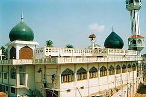
Ayyampettai railway station is located towards Aaharamangudi Road near from Anjuman mosque. The nearest Railway station is Pasupathikovil.
Education
Schools
Schools in Ayyampet Chakkarapalli[3]
- Star Lions Matriculation Higher secondary school,Ayyampettai.
- Government Higher secondary school,Ayyampettai.
- Chakkarapalli panchayat secondary school chakkarapalli.
- Al-Mubeen Matriculation higher secondary school
- Anjuman Matriculation higher secondary school
- City school
- Modern School
- S.I.B.M.S. Higher secondary school, Valuthoor
Associations
Associations in Ayyampet Chakkarapalli[4]
- Paasamalar Welfare Association () 88 708 808 28
- Al Eeman Welfare Association
- Ramalan Welfare Assiociation
References
| District headquarters |  | |
|---|---|---|
| Country | ||
| State | ||
| Region | ||
| Divisions | ||
| Taluks | ||
| Revenue blocks | ||
| Municipal Corporations | ||
| Municipalities | ||
| Rivers | ||
| History | ||
| Places of interest |
| |
| Religious and monastic institutions | ||
| Universities | ||
| ||