Aviré
| Aviré | |
|---|---|
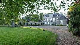 The Château de La Montchevalleraie | |
 Aviré Location within Pays de la Loire region  Aviré | |
| Coordinates: 47°42′25″N 0°47′42″W / 47.7069°N 0.795°WCoordinates: 47°42′25″N 0°47′42″W / 47.7069°N 0.795°W | |
| Country | France |
| Region | Pays de la Loire |
| Department | Maine-et-Loire |
| Arrondissement | Segré |
| Canton | Segré |
| Intercommunality | - |
| Government | |
| • Mayor (-) | - |
| Area1 | 14.36 km2 (5.54 sq mi) |
| Population (2014)2 | 490 |
| • Density | 34/km2 (88/sq mi) |
| Time zone | UTC+1 (CET) |
| • Summer (DST) | UTC+2 (CEST) |
| INSEE/Postal code | 49014 /49500 |
| Elevation |
28–87 m (92–285 ft) (avg. 72 m or 236 ft) |
|
1 French Land Register data, which excludes lakes, ponds, glaciers > 1 km2 (0.386 sq mi or 247 acres) and river estuaries. 2 Population without double counting: residents of multiple communes (e.g., students and military personnel) only counted once. | |
Aviré is a former commune in the Maine-et-Loire department in western France. On 15 December 2016, it was merged into the new commune Segré-en-Anjou Bleu.[1]
Population
| Historical population | ||
|---|---|---|
| Year | Pop. | ±% |
| 1793 | 771 | — |
| 1800 | 554 | −28.1% |
| 1806 | 749 | +35.2% |
| 1821 | 839 | +12.0% |
| 1831 | 1,007 | +20.0% |
| 1836 | 1,017 | +1.0% |
| 1841 | 963 | −5.3% |
| 1846 | 772 | −19.8% |
| 1851 | 804 | +4.1% |
| 1856 | 755 | −6.1% |
| 1861 | 740 | −2.0% |
| 1866 | 756 | +2.2% |
| 1872 | 684 | −9.5% |
| 1876 | 666 | −2.6% |
| 1881 | 712 | +6.9% |
| 1886 | 711 | −0.1% |
| 1891 | 693 | −2.5% |
| 1896 | 672 | −3.0% |
| 1901 | 603 | −10.3% |
| 1906 | 586 | −2.8% |
| 1911 | 653 | +11.4% |
| 1921 | 558 | −14.5% |
| 1926 | 508 | −9.0% |
| 1931 | 491 | −3.3% |
| 1936 | 505 | +2.9% |
| 1946 | 501 | −0.8% |
| 1954 | 462 | −7.8% |
| 1962 | 449 | −2.8% |
| 1968 | 407 | −9.4% |
| 1975 | 370 | −9.1% |
| 1982 | 405 | +9.5% |
| 1990 | 433 | +6.9% |
| 1999 | 424 | −2.1% |
| 2006 | 426 | +0.5% |
| 2009 | 445 | +4.5% |
| 2014 | 490 | +10.1% |
See also
References
- ↑ Arrêté préfectoral 28 September 2016 (in French)
| Wikimedia Commons has media related to Aviré. |
This article is issued from
Wikipedia.
The text is licensed under Creative Commons - Attribution - Sharealike.
Additional terms may apply for the media files.