Aves ditch

Location of Aves ditch in Oxfordshire
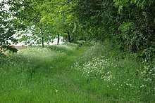
Aves Ditch (also known as Ash Bank, or Wattle Bank) is a pre-Saxon ditch and bank structure running about 3 miles (4.8 km) on a northeast to southwest alignment in the Cherwell District of Oxfordshire.
It is believed to have been both a Roman boundary dyke and an Anglo-Saxon field boundary.[1] It now forms the boundary between the civil parishes of Lower Heyford and Middleton Stoney.
References
External links
| Wikimedia Commons has media related to Aves ditch. |
This article is issued from
Wikipedia.
The text is licensed under Creative Commons - Attribution - Sharealike.
Additional terms may apply for the media files.