Aurach (Regnitz, Oberfranken)
- There exists also another river named Aurach that is a tributary of the Regnitz, see Aurach (Regnitz, Mittelfranken). For other uses, see Aurach (disambiguation).
| Aurach | |
|---|---|
 | |
| Country | Germany |
| Location | Bavaria |
| Physical characteristics | |
| Main source |
east of in Neuschleichach (Oberaurach) 394 metres (1,293 ft) |
| River mouth |
north of Pettstadt into the Regnitz 240 metres (790 ft) 49°50′42″N 10°56′06″E / 49.8450°N 10.9350°ECoordinates: 49°50′42″N 10°56′06″E / 49.8450°N 10.9350°E |
| Length | 39.0 km (24.2 mi) [1] |
| Basin features | |
| Progression | Regnitz→ Main→ Rhine→ North Sea |
| Basin size | 108 km2 (42 sq mi) [1] |
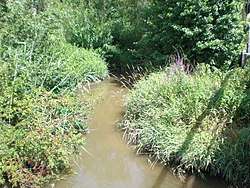
Aurach is a river of Bavaria, Germany. It is a left tributary of the Regnitz in Upper Franconia.
The Aurach has its source in the Steigerwald Nature Park west of the village of Oberaurach, between Euerberg and Beerberg. The Aurach first flows in eastern and then in south-eastern direction, through, among others, the districts Priesendorf and Walsdorf of Oberaurach. Its mouth into the Regnitz is downstream from Stegaurach, just north of Pettstadt and somewhat south of Bamberg.
The river runs in the north parallel to the Rauhe Ebrach, which flows into the Regnitz just one kilometer southwards of the Aurach, and in the south parallel to the Main, which flows in the opposite direction.
See also
References
- 1 2 Complete table of the Bavarian Waterbody Register by the Bavarian State Office for the Environment (xls, 10.3 MB)
This article is issued from
Wikipedia.
The text is licensed under Creative Commons - Attribution - Sharealike.
Additional terms may apply for the media files.