Auqui
| Auqui | |
|---|---|
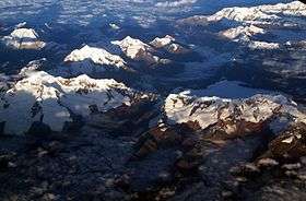 Aerial view of the Cordillera Blanca as seen from the east with Jacabamba and Auqui in the lower center | |
| Highest point | |
| Elevation | 4,800 m (15,700 ft) [1] |
| Coordinates | 9°20′16″S 77°17′29″W / 9.33778°S 77.29139°WCoordinates: 9°20′16″S 77°17′29″W / 9.33778°S 77.29139°W |
| Geography | |
 Auqui Peru | |
| Location | Peru, Ancash Region |
| Parent range | Andes, Cordillera Blanca |
Auqui (possibly from Quechua for prince; a mythical figure of the Andean culture; grandfather)[2][3] is a mountain in the Cordillera Blanca in the Andes of Peru, about 4,800 m (15,748 ft) high. It is situated in the Ancash Region, Huari Province, Huari District. Auqui lies southeast of Jacabamba.[1]
References
- 1 2 escale.minedu.gob.pe - UGEL map of the Huaraz Province (Ancash Region)
- ↑ Teofilo Laime Ajacopa, Diccionario Bilingüe Iskay simipi yuyayk'ancha, La Paz, 2007 (Quechua-Spanish dictionary)
- ↑ Diccionario Quechua - Español - Quechua, Academía Mayor de la Lengua Quechua, Gobierno Regional Cusco, Cusco 2005 (Quechua-Spanish dictionary)
This article is issued from
Wikipedia.
The text is licensed under Creative Commons - Attribution - Sharealike.
Additional terms may apply for the media files.