Auneau
| Auneau | ||
|---|---|---|
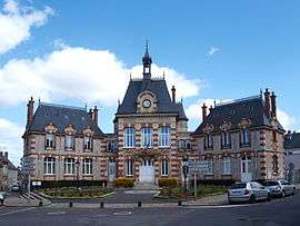 Town hall | ||
| ||
 Auneau Location within Centre-Val de Loire region  Auneau | ||
| Coordinates: 48°27′43″N 1°46′23″E / 48.462°N 1.773°ECoordinates: 48°27′43″N 1°46′23″E / 48.462°N 1.773°E | ||
| Country | France | |
| Region | Centre-Val de Loire | |
| Department | Eure-et-Loir | |
| Arrondissement | Chartres | |
| Canton | Auneau | |
| Intercommunality | - | |
| Government | ||
| • Mayor (-) | - | |
| Area1 | 17.05 km2 (6.58 sq mi) | |
| Population (2013)2 | 4,223 | |
| • Density | 250/km2 (640/sq mi) | |
| Time zone | UTC+1 (CET) | |
| • Summer (DST) | UTC+2 (CEST) | |
| INSEE/Postal code | 28015 /28700 | |
| Elevation |
120–157 m (394–515 ft) (avg. 150 m or 490 ft) | |
|
1 French Land Register data, which excludes lakes, ponds, glaciers > 1 km2 (0.386 sq mi or 247 acres) and river estuaries. 2 Population without double counting: residents of multiple communes (e.g., students and military personnel) only counted once. | ||
Auneau is a former commune in the Eure-et-Loir department in northern France. On 1 January 2016, it was merged into the new commune of Auneau-Bleury-Saint-Symphorien.[1]
Population
| Historical population | ||
|---|---|---|
| Year | Pop. | ±% |
| 1793 | 1,350 | — |
| 1800 | 1,431 | +6.0% |
| 1806 | 1,541 | +7.7% |
| 1821 | 1,585 | +2.9% |
| 1831 | 1,616 | +2.0% |
| 1836 | 1,616 | +0.0% |
| 1841 | 1,652 | +2.2% |
| 1846 | 1,672 | +1.2% |
| 1851 | 1,699 | +1.6% |
| 1856 | 1,741 | +2.5% |
| 1861 | 1,687 | −3.1% |
| 1866 | 1,705 | +1.1% |
| 1872 | 1,736 | +1.8% |
| 1876 | 1,806 | +4.0% |
| 1881 | 1,825 | +1.1% |
| 1886 | 1,838 | +0.7% |
| 1891 | 1,850 | +0.7% |
| 1896 | 1,853 | +0.2% |
| 1901 | 1,946 | +5.0% |
| 1906 | 1,954 | +0.4% |
| 1911 | 2,050 | +4.9% |
| 1921 | 1,920 | −6.3% |
| 1926 | 1,919 | −0.1% |
| 1931 | 1,962 | +2.2% |
| 1936 | 1,867 | −4.8% |
| 1946 | 1,937 | +3.7% |
| 1954 | 1,868 | −3.6% |
| 1962 | 2,014 | +7.8% |
| 1968 | 2,358 | +17.1% |
| 1975 | 2,791 | +18.4% |
| 1982 | 3,183 | +14.0% |
| 1990 | 3,098 | −2.7% |
| 1999 | 3,883 | +25.3% |
| 2008 | 4,086 | +5.2% |
| 2013 | 4,223 | +3.4% |
See also
References
- ↑ Arrêté préfectoral 20 November 2015
| Wikimedia Commons has media related to Auneau. |
This article is issued from
Wikipedia.
The text is licensed under Creative Commons - Attribution - Sharealike.
Additional terms may apply for the media files.