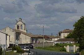
Aubie-et-Espessas
| Aubie-et-Espessas | |
|---|---|
 | |
 Aubie-et-Espessas Location within Nouvelle-Aquitaine region  Aubie-et-Espessas | |
| Coordinates: 45°01′12″N 0°24′20″W / 45.02°N 0.4056°WCoordinates: 45°01′12″N 0°24′20″W / 45.02°N 0.4056°W | |
| Country | France |
| Region | Nouvelle-Aquitaine |
| Department | Gironde |
| Arrondissement | Blaye |
| Canton | Le Nord-Gironde |
| Intercommunality | - |
| Government | |
| • Mayor (-) | - |
| Area1 | 7.55 km2 (2.92 sq mi) |
| Population (2013)2 | 1,246 |
| • Density | 170/km2 (430/sq mi) |
| Time zone | UTC+1 (CET) |
| • Summer (DST) | UTC+2 (CEST) |
| INSEE/Postal code | 33018 /33240 |
| Elevation |
14–56 m (46–184 ft) (avg. 47 m or 154 ft) |
|
1 French Land Register data, which excludes lakes, ponds, glaciers > 1 km2 (0.386 sq mi or 247 acres) and river estuaries. 2 Population without double counting: residents of multiple communes (e.g., students and military personnel) only counted once. | |
Aubie-et-Espessas is a former commune in the Gironde department in southwestern France. On 1 January 2016, it was merged into the new commune Val-de-Virvée.[1]
Population
| Historical population | ||
|---|---|---|
| Year | Pop. | ±% |
| 1962 | 555 | — |
| 1968 | 602 | +8.5% |
| 1975 | 675 | +12.1% |
| 1982 | 901 | +33.5% |
| 1990 | 940 | +4.3% |
| 1999 | 950 | +1.1% |
| 2008 | 1,125 | +18.4% |
| 2013 | 1,246 | +10.8% |
See also
References
- ↑ Arrêté préfectoral 11 December 2015 (in French)
External links
| Wikimedia Commons has media related to Aubie-et-Espessas. |
This article is issued from
Wikipedia.
The text is licensed under Creative Commons - Attribution - Sharealike.
Additional terms may apply for the media files.