Atwater, California
| City of Atwater | |
|---|---|
| City | |
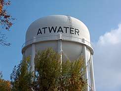 Water tower in the city | |
| Motto(s): Community Pride, City Wide | |
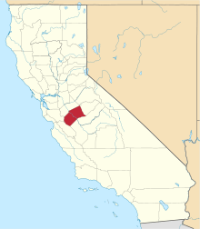
 Location of Atwater in Merced County, California. | |
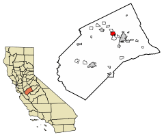
 City of Atwater Location in the United States | |
| Coordinates: 37°20′52″N 120°36′33″W / 37.34778°N 120.60917°WCoordinates: 37°20′52″N 120°36′33″W / 37.34778°N 120.60917°W | |
| Country |
|
| State |
|
| County | Merced |
| Incorporated | August 16, 1922[1] |
| Government | |
| • Mayor | Jim Price[2] |
| • State Senator | Anthony Cannella (R)[3] |
| • Assemblymember | Adam Gray (D)[3] |
| • U. S. Rep. | Jim Costa (D)[4] |
| Area[5] | |
| • Total | 6.10 sq mi (15.79 km2) |
| • Land | 6.09 sq mi (15.78 km2) |
| • Water | 0.01 sq mi (0.01 km2) 0.14% |
| Elevation[6] | 151 ft (46 m) |
| Population (2010) | |
| • Total | 28,168 |
| • Estimate (2017)[7] | 29,397 |
| • Density | 4,825.51/sq mi (1,863.06/km2) |
| Time zone | UTC-8 (Pacific) |
| • Summer (DST) | UTC-7 (Pacific) |
| ZIP codes | 95301, 95342 |
| Area code(s) | 209 |
| FIPS code | 06-03162 |
| GNIS feature ID | 277600 |
| Website |
www |
Atwater is a city on State Route 99 in Merced County, California, United States. Atwater is 8 miles (13 km) west-northwest of Merced,[8] at an elevation of 151 feet (46 m).[6] The population as of the 2010 census was 28,168.
Geography
According to the United States Census Bureau, the city has a total area of 6.1 square miles (16 km2). 99.86% of it is land and 0.14% water.
The city includes Castle Air Museum, but does not include Castle Air Force Base proper.
History
The railroad reached Atwater in the 1870s, and a town grew up.[8] The first post office opened in 1880.[8] Atwater incorporated in 1922.[8] The name honors Marshall D. Atwater, a wheat farmer whose land was used by the railroad for its station.[8]
Demographics
| Historical population | |||
|---|---|---|---|
| Census | Pop. | %± | |
| 1930 | 917 | — | |
| 1940 | 1,235 | 34.7% | |
| 1950 | 2,856 | 131.3% | |
| 1960 | 7,318 | 156.2% | |
| 1970 | 11,640 | 59.1% | |
| 1980 | 17,530 | 50.6% | |
| 1990 | 22,282 | 27.1% | |
| 2000 | 23,113 | 3.7% | |
| 2010 | 28,168 | 21.9% | |
| Est. 2017 | 29,397 | [7] | 4.4% |
| U.S. Decennial Census[9] | |||
2010
The 2010 United States Census[10] reported that Atwater had a population of 28,168. The population density was 4,620.8 people per square mile (1,784.1/km²). The racial makeup of Atwater was 18,410 (65.4%) White, 14,808 (52.6%) Hispanic or Latino of any race, 1,225 (4.3%) African American, 364 (1.3%) Native American, 1,416 (5.0%) Asian, 76 (0.3%) Pacific Islander, 5,300 (18.8%) from other races, and 1,377 (4.9%) from two or more races.
The Census reported that 28,066 people (99.6% of the population) lived in households, 31 (0.1%) lived in non-institutionalized group quarters, and 71 (0.3%) were institutionalized.
There were 8,838 households, out of which 4,255 (48.1%) had children under the age of 18 living in them, 4,593 (52.0%) were opposite-sex married couples living together, 1,558 (17.6%) had a female householder with no husband present, 672 (7.6%) had a male householder with no wife present. There were 615 (7.0%) unmarried opposite-sex partnerships, and 60 (0.7%) same-sex married couples or partnerships. 1,615 households (18.3%) were made up of individuals and 738 (8.4%) had someone living alone who was 65 years of age or older. The average household size was 3.18. There were 6,823 families (77.2% of all households); the average family size was 3.61.
The population was spread out with 9,016 people (32.0%) under the age of 18, 2,968 people (10.5%) aged 18 to 24, 7,492 people (26.6%) aged 25 to 44, 5,760 people (20.4%) aged 45 to 64, and 2,932 people (10.4%) who were 65 years of age or older. The median age was 30.0 years. For every 100 females, there were 95.7 males. For every 100 females age 18 and over, there were 90.5 males.
There were 9,771 housing units at an average density of 1,602.9 per square mile (618.9/km²), of which 4,905 (55.5%) were owner-occupied, and 3,933 (44.5%) were occupied by renters. The homeowner vacancy rate was 3.3%; the rental vacancy rate was 10.9%. 14,920 people (53.0% of the population) lived in owner-occupied housing units and 13,146 people (46.7%) lived in rental housing units.
2000
As of the census[11] of 2000, there were 23,113 people, 7,247 households, and 5,667 families residing in the city. The population density was 4,277.4 people per square mile (1,652.6/km²). There were 8,114 housing units at an average density of 1,501.6/sq mi (580.2/km²). The racial makeup of the city was 57.34% White, 4.99% Black or African American, 1.27% Native American, 5.43% Asian, 0.36% Pacific Islander, 24.48% from other races, and 6.14% from two or more races. 41.51% of the population were Hispanic or Latino of any race.
There were 7,247 households out of which 45.9% had children under the age of 18 living with them, 55.9% were married couples living together, 16.3% had a female householder with no husband present, and 21.8% were non-families. 17.6% of all households were made up of individuals and 6.9% had someone living alone who was 65 years of age or older. The average household size was 3.15 and the average family size was 3.55.
In the city, the population was spread out with 34.9% under the age of 18, 10.0% from 18 to 24, 28.6% from 25 to 44, 17.4% from 45 to 64, and 9.1% who were 65 years of age or older. The median age was 28 years. For every 100 females, there were 94.6 males. For every 100 females age 18 and over, there were 90.4 males.
The median income for a household in Atwater is $37,344, and the median income for a family was $39,789. Males had a median income of $32,983 versus $22,450 for females. The per capita income for the city was $15,162. About 15.3% of families and 18.7% of the population were below the poverty line, including 25.1% of those under age 18 and 5.3% of those age 65 or over.
Government
In the California State Legislature, Atwater is in the 12th Senate District, represented by Republican Anthony Cannella, and in the 21st Assembly District, represented by Democrat Adam Gray.[3]
In the United States House of Representatives, Atwater is in California's 16th congressional district, represented by Democrat Jim Costa.[4]
Education
Primary and secondary schools
Private School St.Anthony's (Preschool, K-8)
Public schools
Most of the city is zoned to the Atwater Elementary School District. Schools of AESD within Atwater and serving Atwater include:[12]
- K-6
- K-8
- 7-8
- Other
A small section of eastern Atwater is located in the Merced City School District; that section is zoned to Rivera Middle School.[13] Franklin Elementary School is the closest elementary school to the section of Atwater.
Merced Union High School District operates Atwater High School and Buhach Colony High School, both of which serve and reside in Atwater.
Private schools
| School | Grades |
|---|---|
| Ariel Dear Academy | 2-12 |
| Fruitland Christian Preschool | PK-K |
| Landmark Christian School | PK-12 |
| St. Anthony School | PK-8 |
Newspapers
Atwater currently does not have a daily newspaper, although many of its residents use the daily paper, the Merced Sun-Star, which is published in nearby Merced. Additionally Atwater residents rely on local Facebook pages such as "Merced county news". Atwater has two weekly newspapers called The Atwater Signal and The Atwater Times. The Atwater Signal was first published in 1911. The Atwater Times[14] is published by Mid Valley Publications, once a week.
Notable residents
- Chuck Compton, NFL Green Bay Packers defensive back
- Thomas W. Hayes, former California State Treasurer
- Carrie Henn played Rebecca "Newt" Jorden in the 1986 film Aliens
- Jamill Kelly, 2004 Olympics silver medal in wrestling
- Sheryl Underwood, American actress
Sports
- [15] Atwater Aviators - collegiate baseball of the Golden State Collegiate Baseball League. Atwater Falcons - Football and Baseball.[16] Buhach Colony Thunder - Football and Basketball
See also

- List of cities and towns in California
References
- ↑ "California Cities by Incorporation Date". California Association of Local Agency Formation Commissions. Archived from the original (Word) on November 3, 2014. Retrieved August 25, 2014.
- ↑ "City of Atwater". Archived from the original on January 26, 2016. Retrieved December 29, 2014.
- 1 2 3 "Statewide Database". UC Regents. Retrieved December 10, 2014.
- 1 2 "California's 16th Congressional District - Representatives & District Map". Civic Impulse, LLC. Retrieved October 1, 2014.
- ↑ "2017 U.S. Gazetteer Files". United States Census Bureau. Retrieved Aug 27, 2018.
- 1 2 U.S. Geological Survey Geographic Names Information System: Atwater, California
- 1 2 "Population and Housing Unit Estimates". Retrieved March 24, 2018.
- 1 2 3 4 5 Durham, David L. (1998). California's Geographic Names: A Gazetteer of Historic and Modern Names of the State. Clovis, Calif.: Word Dancer Press. p. 741. ISBN 1-884995-14-4.
- ↑ "Census of Population and Housing". Census.gov. Archived from the original on May 12, 2015. Retrieved June 4, 2015.
- ↑ "2010 Census Interactive Population Search: CA - Atwater city". U.S. Census Bureau. Retrieved July 12, 2014.
- ↑ "American FactFinder". United States Census Bureau. Archived from the original on September 11, 2013. Retrieved 2008-01-31.
- ↑ "Archived copy". Archived from the original on 2008-05-09. Retrieved 2008-09-02.
- ↑ "Proposed Middle School Boundaries 2008-2009." Merced City School District.
- ↑ "Newspaper Advertising - Nationwide Classified or Display Ads Cheap". www.usnewspapers.com. Retrieved 17 April 2018.
- ↑ "Atwater Aviators - Golden State Collegiate Baseball League". pointstreaksites.com. Retrieved 17 April 2018.
- ↑ "MascotDB.com - Atwater Angels". www.mascotdb.com. Retrieved 17 April 2018.
- Compass Maps: Merced, Atwater, Merced County
- City of Atwater -- Approved Annexations
External links
| Primary and secondary schools | |
|---|---|
| Colleges and universities |
|
| Landmarks | |
This list is incomplete. The air force base and museum are near Atwater but are not in the city limits.
| |