Atures Municipality
| Autònomo Atures Municipality Municipio Autònomo Atures | |||
|---|---|---|---|
| Municipality | |||
| |||
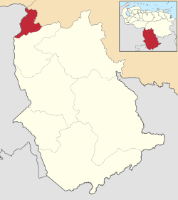 Location in Amazonas | |||
.svg.png) Autònomo Atures Municipality Location in Venezuela | |||
| Coordinates: 5°41′33″N 67°24′23″W / 5.6925°N 67.4063°WCoordinates: 5°41′33″N 67°24′23″W / 5.6925°N 67.4063°W | |||
| Country |
| ||
| State | Amazonas | ||
| Municipal seat | Puerto Ayacucho | ||
| Government | |||
| • Mayor | Mireya Labrador (PPT) | ||
| Area | |||
| • Total | 4,500 km2 (1,700 sq mi) | ||
| Population (2011) | |||
| • Total | 104,228 | ||
| • Density | 23/km2 (60/sq mi) | ||
| Time zone | UTC−04:00 (VET) | ||
| Area code(s) | 0248 | ||
| Website | Official website | ||

The Atures Municipality is one of the seven municipalities (municipios) that makes up the southern Venezuelan state of Amazonas and, according to the 2011 census by the National Institute of Statistics of Venezuela, the municipality has a population of 104,228.[1] The city of Puerto Ayacucho is the shire town of the Atures Municipality.[2]
History
The city of Puerto Ayacucho was founded to facilitate the transport of goods past the Atures Rapids on the Orinoco River in the late 19th century (mostly rubber).
Demographics
The Atures Municipality, according to a 2007 population estimate by the National Institute of Statistics of Venezuela, has a population of 91,386 (up from 74,066 in 2000). This amounts to 64.3% of the state's population.[3] The municipality's population density is 20.3 inhabitants per square kilometre (53/sq mi).[4]
Government
The mayor of the Atures Municipality is Mireya Labrador, elected on October 31, 2004 with 39% of the vote.[5] She replaced Angel Rodriguez shortly after the elections.[6] The municipality is divided into four parishes; Fernando Girón Tovar, Luis Alberto Gómez, Parhueña, and Platanillal (previous to December 18, 1997, the Atures Municipality contained only a single parish).[2]
See also
References
- ↑ http://www.geohive.com/cntry/venezuela_ext.aspx
- 1 2 http://www.ocei.gov.ve/secciones/division/Amazonas.zip%5Bpermanent+dead+link%5D
- ↑ http://www.ocei.gov.ve/sintesisestadistica/estados/amazonas/cuadros/Poblacion5.xls%5Bpermanent+dead+link%5D
- ↑ http://www.ocei.gov.ve/sintesisestadistica/estados/amazonas/cuadros/Poblacion4.xls%5Bpermanent+dead+link%5D
- ↑ http://www.cne.gob.ve/regionales2004/22/alcaldedis=0&edo=22&mun=1&par=0&cen=0&mesa=0&cua=0.html
- ↑ "Archived copy" (PDF). Archived from the original (PDF) on October 2, 2006. Retrieved March 15, 2008.
External links
- atures-amazonas.gob.ve (in Spanish)