Athani, Belgavi
| Athani athni | |
|---|---|
| City | |
 | |
 Athani Location in Karnataka, India | |
| Coordinates: 16°44′N 75°04′E / 16.73°N 75.07°ECoordinates: 16°44′N 75°04′E / 16.73°N 75.07°E | |
| Country |
|
| State |
|
| District | Belagavi |
| Regions of Karnataka | Bayaluseeme |
| Town municipal council | 1853 |
| Government | |
| • Type | Taluk administration |
| • Body | Athani municipal council |
| Area | |
| • Total | 15.00 km2 (5.79 sq mi) |
| Elevation | 554 m (1,818 ft) |
| Population (2011) | |
| • Total | 63,625 |
| • Density | 4,200/km2 (11,000/sq mi) |
| Languages | |
| • Official | Kannada |
| Time zone | UTC+5:30 (IST) |
| PIN | 591304 |
| Telephone code | 08289 |
| Vehicle registration | KA-23 |
| Sex ratio | 958[1][2] ♂/♀ |
| Website |
www |
Athani is a city next to Gokak in the Belgaum district of Karnataka, India. It is 140 kilometers from the city of Belagavi, 70 kilometers from Vijayapura, 55 kilometers from Miraj, 100 kilometers from Kolhapur, 200 kilometers from Hubballi, and 624 kilometers from Bengaluru. The main profession here is agriculture, particularly sugarcane, jawar, and grapes. The river Krishna flows 110 km around the southern part of Athani Taluk. the city 18 km from river Krishna It is the largest sugar production Taluk in Karnataka. It is famous for leather chappals. Athani is the oldest municipal town of Karnataka; it was established in 1853 according to the municipal act of 1850,The municipal council completed 160 years.
Transportation
Athani is connected to various places like Shedbal, Vijayapura, Miraj, Sangli, Chikkodi, Ugar, and Jamkhandi and the town has NWKRTC bus service. The nearest railway station is Ugar railway station which is 25 km from the city and Miraj junction 55 km from Athani. Belagavi and Kolhapur are the nearest airports. There are 24×7 buses for the cities Vijayapura and Belagavi.
There is a proposal for a new railway line between Vijayapura – Shedbal- Athani to connect Vijayapura with Belagavi. A survey of this 112.3-km new railway line is completed and submitted to South Western Railway Hubballi.
The city is well connected by roads. The three state highways pass through the city: SH-12(Jewargi-Sankeshwar), SH-31(Jath-Jambothi), and SH-72 (Nippani-muhanddi). Four major roads pass through the city. the national highway (vijapur-sankeshwar) is sanctioned.
Demographics
As of 2011 India census,[3][4] Athani had a population of 63,625 acc to the area 15 km2 including adjacent two villages in it . Males constitute 51% of the population and females 49%. Athani has an average literacy rate of 74%, higher than the national average, with 69% of the males and 79% of females literate. 14% of the population is under 6 years of age.
Climate
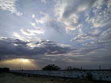
Being situated in upper region of Belagavi district which lies in the elevated terrain of north-western Karnataka,Athani has a tropical climate. It is known for its moderately climate throughout the year. Athani receives rainfall from both the northeast and the southwest monsoons and the wettest months are June–September.[5][6] It has a distinct normal climate in every season. extreme climate should not found here. June and August have a good deal of rainfall, while the winters have very little. The coldest month is December with an average low temperature of 25.3 °C and the hottest month is may with an average high temperature of 40 °C. Winter temperatures rarely drop up to 18 °C (54 °F), and summer temperatures seldom exceed 30–40 °C.The driest month is January, with 10 mm of rainfall.[7][8][9]
| Climate data for Athani,Karnataka | |||||||||||||
|---|---|---|---|---|---|---|---|---|---|---|---|---|---|
| Month | Jan | Feb | Mar | Apr | May | Jun | Jul | Aug | Sep | Oct | Nov | Dec | Year |
| Average high °C (°F) | 30 (86) |
31 (88) |
33 (91) |
36 (97) |
39 (102) |
31 (88) |
32 (90) |
28 (82) |
30 (86) |
31 (88) |
30 (86) |
29 (84) |
39 (102) |
| Daily mean °C (°F) | 25 (77) |
26 (79) |
26.5 (79.7) |
30.5 (86.9) |
32.5 (90.5) |
28 (82) |
28.5 (83.3) |
26 (79) |
27 (81) |
26.5 (79.7) |
25 (77) |
23 (73) |
27 (81) |
| Average low °C (°F) | 20 (68) |
21 (70) |
22 (72) |
25 (77) |
26 (79) |
25 (77) |
25 (77) |
24 (75) |
24 (75) |
22 (72) |
20 (68) |
19 (66) |
19 (66) |
| Average precipitation mm (inches) | 21 (0.83) |
01 (0.04) |
0 (0) |
21 (0.83) |
48.7 (1.917) |
580.3 (22.846) |
700 (27.56) |
500 (19.69) |
230 (9.06) |
80.6 (3.173) |
57 (2.24) |
65 (2.56) |
700 (27.56) |
| Mean monthly sunshine hours | 262.9 | 246.5 | 274.7 | 260.5 | 241.8 | 158.0 | 142.4 | 136.7 | 164.0 | 191.7 | 221.4 | 232.6 | 2,533.2 |
| Source #1: Yearly weather forecasts[10][11] | |||||||||||||
| Source #2: Indian Meteorological Department[12][13][14] | |||||||||||||
Culture
Athani has typical North Karnataka culture. Janapada (folk) songs and dances are found in villages surrounding Athani. The god of the town is the Siddheshwara. The Siddheshwara Temple and is prayed by the locals on Mondays every year in Athani Devotional Siddeswara fair takes place. Sri Murughendra Shivoygi's birthplace, Nadi Ingalgav falls in the Athani Taluk. Sri Shivyogi MurughSendra Swamiji is a great santa lived in Gachhinamath in Athani. He is shivasharna. He makes many pavadas to bless people he is one of great santa in Karnataka in his name there is mathas in Dharwad and Chitradurga. And he make pavada on a child and thant child get cured from disease he is called Marulashankar Devaru he had power of detecting underground water he is a great santa who lived in Gachhinamath in Athani. The Raghavendra swamji Rathotsava takes place in Athani. In this city there are five mathas:
- Gachhinamath
- Mothagimath
- Gothkindimath
- Shettaramath
- Raghavendra swami math
And in this city an ancient of 500 years old temple Amruthalingeshwar temple is the Kokatnoor Yallama, Katageri Lakkavva, Avarkhod Hanumappa are other holy places that draw devotees from as far afield as Maharashtra.
Aigali husbandry fair is the biggest husbandry fair in India. Many fairs take place in the villages surrounding Athani. Athani has produced many well-known Kannada poets and writers. Its contribution to Kannada literature is considerable. Kannada is the main and spoken language.
Athani Taluk
Athani Taluk is the largest taluk in a Belagavi district; it has a total area of 2070.54 km2,[15] 74% is cultivated. This includes 115 inhabited villages and hamlets with a rural population of 4,07,485 as per the 2011 census. The total population of taluk is 5,25,832 . The taluk is bounded by Sangli district of Maharashtra in the north, Vijayapura district in the east, and Krishna river in the south.it flows 110 km in the taluk.Geologically the area is covered by Deccan Trap formation. The average annual rainfall is 582 mm. The two rivers that flow here are Krishna and Agrani river. Agrani is beside the pandegao, shirur, ajur, sambargi, nagnur (p.a.), tawanshi, and kalloti.
The five largest towns of Athani Taluk (sorted in order of decreasing population) are Athani, Ugar, Ainapur, Kagawad, Shedbal. The river Krishna flows around the Athani taluk. Five sugar industries are in this taluk. They are located in Athani,Shinal,Kagawad, Kokatnur, Ugar and Kempwad . There are four hobalis in this taluk: Athani, Kagawad, Telsang and Anatapur. Most of the land is fully fertile; some of the land is dry and hilly.
Educational institutions
- Jadhavaji Anandji Education or JE society is one of the premier educational institutes of Athani. This institution is as old as pre-independence and started in 1918 to education for many studendts in Athani.Sudha murthi gave donation to this society. This society was started by Jadhavji and Anandji of Athani before independence in 1918. it is the first educational society in Athani.
- Athani J.Society's English medium School is one of the best schools in Athani.
- Government Polytechnic, Athani (best diploma college of Athani)
- K.L.E. (Karnataka Lingayat Education) Society is the premiere educational institutions of Karnataka with its head office located in Belgaum which is the district headquarters of Athani. KLE has a degree college, a high school, C.B.S.E. School (I to X) and a primary school in Athani. This society was started by Murugendra Shivayogi. He suggested the Lingaraj desai (founder of KLE Society) to establish an education society to give education to students when the Lingaraj Desai wanted to give his all property to the Gachinnamath in Athani. Because Lingaraj Desai did not have children, then he talked with Murugendra Shivayogi and established KLE Society.
- C S Kittur High School
- Azad Education Society runs the Abul Kalam Urdu High School as well as Alhaj Abdullah D Ed. College.
- Sanjay Gandhi Education Trust's English Medium School, Athani is the most preferred school.
- Shri Shivayogi Murughendra Swami (SSMS) College and Channappa Shivarudrappa Kittur (CSK) High School are run by KLE Society.
- K.L.E. Society's, C.B.S.E. English Medium School
- A S Pangi Institute Of Paramedical Sciences.
- Government high school Athani, recommended by NAAC committee.
- Shree Murughendra Swamiji (SMS) High school Shegunashi is run by Murughendra Swamiji Math.
- SRSDF's Smt Shantabai deshpande public school kokatanur - Athani is one of the best CBSE schools in north Athani.
Athani also has government primary schools for boys and girls in Kannada, Urdu and Marathi Mediums.
- Sanghamitra high school Sambargi.
- Satvasheeladevi Girl's High School (managed by J.E. Society which also manages J.A. High School) is a premier school exclusively catering to female students.
- J E Society English medium school
- J E Society's Venkatesh Jere Primary School
- Shree Marul Shankar Devaru School is located in Uppinamal.
- S.P. Mandal Raibfas S.G.S COPM. PU College Madabahvi
- S.G.S. Arts College Madabahvi
- VVS GNK High school & primary school since 1964
Tourist attractions
- Kohalli Sri Sangameshwar Temple, The Village is located on the Way of Athani to Guddapur (Sri Dannamma Devi Temple)
- Khavatakopp Anjaneya Temple. (sarakari Anjaneya). This temple located near krishna river.
- Athani kalmeshwara temple is built in chalky and hoisalas. Rear monuments shivalinga front of nandi.and beautiful architecture.
- Athani Siddeshwara Temple has the architecture of a mosque. Built in stone, it was recently clad with marble. It is main deity of Athani town. It is said that Adilshah of Vijayapura got it constructed sometime in 15th or 16th century AD.
- Athani J.A. High School is one of the oldest schools in Athani which was established in 1918. Main building has a unique architecture.
- Khilegavi (famous Basaveshwar Temple situated in Khiilegavi)
- Kokatanur (famous Yellamma temple)
- Gachhina math (famous Athani Shivayogi temple) is a place of lord Murugendra Shivayogi and Marulashankar Devaru .
- A Raghavendra Swamiji Math was built by the late Shri Bhimdas. This place is also known as Abhinav Mantralaya.
- Shri Murugendra Swamiji Math in Shegunasi is an oldest Math in Shegunasi wel design and architecture, the Math conducting fest in akshadata amavashya of every year.
- Savadi Venu Gopal Temple (also known as Gopalkrishna Temple) situated on the bank of Krishna River at Savadi is perhaps the oldest temple in Athani Taluka. In the sanctum sanctorum of the temple Venu Gopal is the presiding deity. It is a typical Trikuteshwar type temple where apart from the presiding deity, other two vigrahas on either side of the main sanctum sanctorum are two impressive Shivlings. According to the archeological study the temple is about 1000–1200 years old
- Chamakeri: (sadashiva swamiji (babaladi)) located in Chamakeri 15 km from Athani taluk.
- Statue of Shivaji: in Sambargi Shivaji is one of the statues in north Athani. Is proud of all Sambargi people.[16]
- TANVASHI shree dattareya temple
- Ramathirth: there is a temple of lord Rameshwar of old stone temple of 800 years old and one of the cave is located behind the temple ; it is a tourist place.
- AVARKHOD: hanuman temple, it is a tourist place.it is oldest temple.
- badgi: badgi is the small village in Athani it is the one of the tourism place, kalmeshwara temple which was dated in 12th century basavannas time there founded rear monuments and shivalinga and also that times SHASANA which is written in old Kannada language. There is no development of the temple. vdydr.
Nandgao: old temple is located near school. Old monuments founded. vdydr.
Agriculture
In Athani agriculture is the main occupation.About 60% of the total population is engaged in agriculture.The main crops are: jawar, wheat, sunflower, toordal, and kushbi. The commercial crops are sugarcane, grapes, wheat and ground nut. Few varietiesof vegetables like tomatoes, brinjals, ladies fingers, green leaves and redchillies are also grown With the limited rainfall, diesel power pumpsets are in vogue for the available water supply. And the main commercial crop is sugarcane. Athani is one of the largest sugarcane cultivation taluks in Karnataka. 70% of the land is fertile. Sugarcane is cultivated near river Krishna and river Agrani. It is cultivated more than 1,50,000 acres in taluk. Irrigation facilities of Hipparagi barrage of Upper Krishna Projectis in athani. By this project canals were constructed. It is very helpful for cultivation of sugarcane and grapes. The Hipparagi project is useful to farmers. Most of farmers cultivate sugarcane and jawar.
Industries
There are many industries located in Athani taluk like sugar industry, chappal factories, glucose and mills.
Chappal factory
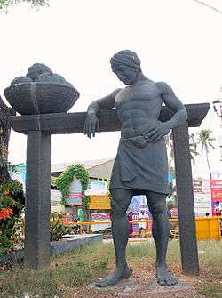
The Athani is famous for leather chappals scheduled caste families forming considerable chunk of the local population. This serves a special mention because of the valid contribution of few sub groups to the now famous leather products of Athani. The sub-groups are Dhors and Samagars who are mostly engaged in this leather trade and are traditional leather workers. Dhors are specialized in tanning of hides and skins, while Samagars have proved as intricate craftsmen to produce leather foot wears .Recognizing this, the Khadi and village industries commission established a footwear manufacturing centre under the name "Charmalaya". The success of this paved the way towards another milestone, where ‘Lidkar’ backed by the State Government, saw the light of the day, boosting the activity of footwear manufacturing further. The foot-wears are marketed throughout India by the respective outlets. The traders from other part of the country also procure leather goods from Athani, to market them in their areas. Through the State Trading Corporation, these leather goods are also exported to many countries where they have found a sizeable market.The category which has established itself by way of its design and quality is known as ‘Kolhapuri Chappals’ which has a great demand in local as well as the export markets. These goods were exported to foreign countries like Scotland, Netherlands, England and others.
Sugar Industry
Previously there is no sugar industry was there in this taluk. But farmers transported the sugarcane to Maharashtra. Then farmers requested to establish the sugar industry in Athani Taluk. And then many sugar industries were started in this taluk.
In Athani Taluk the first sugar industry was established by Ugar sugars pvt ltd in Ugar,it produce more than 12,000 tonnes.
See also
References
- ↑ "Belgaum District Stats". City Municipal Commissioner of Belgaum, Govt. of Karnataka. 10 July 2012. Retrieved 25 May 2013.
- ↑ "Population Census of Karnataka, 2011" (PDF). Government of India.
- ↑ "Census of India 2011: Data from the 2011 Census, including cities, villages and towns (Provisional)". Census Commission of India. Archived from the original on 2004-06-16. Retrieved 2008-11-01.
- ↑ "Census of India 2001: Data from the 2001 Census, including cities, villages and towns (Provisional)". Census Commission of India. Archived from the original on 2004-06-16. Retrieved 2008-11-01.
- ↑ "Southwest and Northeast monsoons in India". Dept. of Environment, Govt. of Maharashtra. Retrieved Jan 2012. Check date values in:
|accessdate=(help) - ↑ "Southwest monsoon maps". mapsofindia.com.
- ↑ "Forecasting manuals for Southwest Monsoons". Indian Meteorological Department, Govt. of India. Retrieved November 2011. Check date values in:
|accessdate=(help) - ↑ "Weather maps for surface temperature". myweather2.com. Retrieved June 2012. Check date values in:
|accessdate=(help) - ↑ "Weekly Rainfall predictions". Indian Meteorological Department, Govt. of India. Retrieved June 2012. Check date values in:
|accessdate=(help) - ↑ "Yearly weather forecast for Gokak". meoweather.com. Retrieved June 2009. Check date values in:
|accessdate=(help) - ↑ "Mean monthly sunshine hours for Karnataka". worldreviewer.com.
- ↑ "Indian Meteorological Department". Indian Meteorological Department, Govt. of India. Retrieved January 2001. Check date values in:
|accessdate=(help) - ↑ "Satellite Imaging for weather forecast". Indian Meteorological Department, Govt. of India.
- ↑ "Weather data from 1901–2000" (PDF). Indian Meteorological Department, Govt. of India. Archived from the original (PDF) on 2015-10-17. Retrieved August 2011. Check date values in:
|accessdate=(help) - ↑ Karnataka Information Centre's profile on Athani Taluk Archived 18 April 2007 at the Wayback Machine.
- ↑ {{cite
- CHANDRAGIRI TEMPLE IN SAMBARGI; Gramdaivat of SAMBARGI PEOPLE
External links
- www
.kar .nic .in /zpbelgaum /athaniprofile .htm - www
.athanitown .gov .in .com .html - www
.karunadu .in .com .htm - www
.india .gov .com .htm - 591304
- www
.athanitown .gov .in - www
.ramtheerth .in .com - www
.klessms .in .com
Places adjacent to Athani, Belgavi | ||||||||||
|---|---|---|---|---|---|---|---|---|---|---|
| ||||||||||