Aslockton railway station
| Aslockton | |
|---|---|
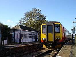 A Skegness-bound train at Aslockton station | |
| Location | |
| Place | Aslockton |
| Local authority | Rushcliffe |
| Grid reference | SK705401 |
| Operations | |
| Station code | ALK |
| Managed by | East Midlands Trains |
| Number of platforms | 2 |
| DfT category | F2 |
|
Live arrivals/departures, station information and onward connections from National Rail Enquiries | |
| Annual rail passenger usage* | |
| 2012/13 |
|
| 2013/14 |
|
| 2014/15 |
|
| 2015/16 |
|
| 2016/17 |
|
| History | |
| Key dates | Opened 15 July 1850 |
| National Rail – UK railway stations | |
| * Annual estimated passenger usage based on sales of tickets in stated financial year(s) which end or originate at Aslockton from Office of Rail and Road statistics. Methodology may vary year on year. | |
|
| |
Aslockton railway station serves the villages of Aslockton and Whatton in Nottinghamshire, England. The station is 10¾ miles (17 km) east of Nottingham on the Nottingham-Skegness Line.
History
Passenger services from Aslockton started on 15 July 1850,[1] when the Ambergate, Nottingham, Boston and Eastern Junction Railway opened its extension from Nottingham to Grantham. This was taken over by the Great Northern Railway.[2] The station building designed by Thomas Chambers Hine was opened by the Great Northern Railway in 1857.
On 12 October 1868 a goods train which had departed Nottingham at 4.15 am split near Aslockton station when one of the coupling chains broke. The driver shunted on to the down line, and whilst getting back upon the up line another goods train from Grantham ran into it. The driver of the train from Grantham, Smalley Hutchinson was killed, and the fireman severely injured.[3]
On 31 December 1904, George Skillington, aged 78, was killed on the line at Aslockton by a light engine.[4]
The station became part of the London and North Eastern Railway during the Grouping of 1923.
On 23 July 1933 an excursion train from Skegness to Nottingham crashed through the level crossing gates at Aslockton.[5] On 1 August 1937, a nine-year-old boy, Ernest Love of Sneinton, Nottingham, fell from a Nottingham to Mablethorpe excursion train at Aslockton and was killed.[6]
The station passed on to the Eastern Region of British Railways on nationalisation in 1948. When Sectorisation was introduced in the 1980s, the station was served by Regional Railways until the Privatisation of British Railways. The station is now managed by East Midlands Trains.
Current services
There are trains every hour or two to Nottingham, and trains every hour or two to Boston and Skegness via Grantham. There are less frequent trains to destinations such as Norwich and Liverpool Lime Street.
| Preceding station | Following station | |||
|---|---|---|---|---|
| East Midlands Trains |
Former services
| Preceding station | Disused railways | Following station | ||
|---|---|---|---|---|
| Bingham | Great Northern Railway Nottingham to Grantham Nottingham to Newark |
Elton | ||
References
- ↑ "Ambergate, Nottingham and Boston, and Eastern Junction Railway". Nottingham Review and General Advertiser for the Midland Counties. England. 12 July 1850. Retrieved 29 June 2017 – via British Newspaper Archive. (Subscription required (help)).
- ↑ Kingscott, G., (2004) Lost Railways of Nottinghamshire, Newbury: Countryside Books
- ↑ "Fatal Railway Collision on the Nottingham and Grantham Line". Grantham Journal. England. 17 October 1868. Retrieved 29 June 2017 – via British Newspaper Archive. (Subscription required (help)).
- ↑ "Aslockton. Shocking accident on the Railway". Grantham Journal. England. 7 January 1905. Retrieved 29 June 2017 – via British Newspaper Archive. (Subscription required (help)).
- ↑ "Local Happenings. Nottingham Train Crashes Through Gate". Nottingham Evening Post. England. 24 July 1933. Retrieved 29 June 2017 – via British Newspaper Archive. (Subscription required (help)).
- ↑ "Inquest story of fall from train". Nottingham Evening Post. England. 3 August 1937. Retrieved 29 June 2017 – via British Newspaper Archive. (Subscription required (help)).
- Butt, R. V. J. (1995). The Directory of Railway Stations: details every public and private passenger station, halt, platform and stopping place, past and present (1st ed.). Sparkford: Patrick Stephens Ltd. ISBN 978-1-85260-508-7. OCLC 60251199.
- Jowett, Alan (2000). Jowett's Nationalised Railway Atlas (1st ed.). Penryn, Cornwall: Atlantic Transport Publishers. ISBN 978-0-906899-99-1. OCLC 228266687.
- Jowett, Alan (March 1989). Jowett's Railway Atlas of Great Britain and Ireland: From Pre-Grouping to the Present Day (1st ed.). Sparkford: Patrick Stephens Ltd. ISBN 978-1-85260-086-0. OCLC 22311137.
- Station on navigable O.S. map
External links
- Train times and station information for Aslockton railway station from National Rail
- Aslockton Station Master's House
- Train at Aslockton Station
- PDF with images of signal box and station