Ashurst, Arizona
| Ashurst, Arizona | |
|---|---|
| Populated place | |
 Ashurst  Ashurst | |
| Coordinates: 32°59′03″N 109°55′56″W / 32.98417°N 109.93222°WCoordinates: 32°59′03″N 109°55′56″W / 32.98417°N 109.93222°W | |
| Country | United States |
| State | Arizona |
| County | Graham |
| Elevation[1] | 2,739 ft (835 m) |
| Time zone | UTC-7 (Mountain (MST)) |
| • Summer (DST) | UTC-7 (MST) |
| Area code(s) | 520 |
| FIPS code | 04-04475 |
| GNIS feature ID | 25297 |
Ashurst is a populated place situated in Graham County, Arizona, and appears on the Eden U.S. Geological Survey Map.[2] It has an estimated elevation of 2,739 feet (835 m) above sea level.[1]
References
- 1 2 "Feature Detail Report for: Ashurst". Geographic Names Information System. United States Geological Survey.
- ↑ "Ashurst (in Graham County, AZ) Populated Place Profile". AZ Hometown Locator. Archived from the original on January 24, 2016. Retrieved January 24, 2016.
Municipalities and communities of Graham County, Arizona, United States | ||
|---|---|---|
| City | 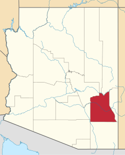 | |
| Towns | ||
| CDPs | ||
| Populated places | ||
| Indian reservations | ||
| Ghost towns | ||
| Footnotes | ‡This populated place also has portions in an adjacent county or counties | |
This article is issued from
Wikipedia.
The text is licensed under Creative Commons - Attribution - Sharealike.
Additional terms may apply for the media files.