Ashton-under-Lyne bus station
Ashton-under-Lyne | |
|---|---|
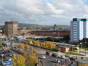 Ashton-Under-Lyne bus station and tram stop. | |
| Location |
Ashton-under-Lyne Tameside |
| Operated by | Transport for Greater Manchester |
| Bus stands | 15 |
| Bus operators | |
| Connections | Ashton-under-Lyne railway station |
| History | |
| Opened | 1994 |
Ashton-under-Lyne bus station is a bus station that is located in the town of Ashton-under-Lyne in Greater Manchester, run by Transport for Greater Manchester. The bus station is situated on Wellington Road and adjoins the Arcades Shopping Centre. The bus station was opened in 1994 and replaced the previous bus station that was built on the current site.
Ashton-under-Lyne tram stop is alongside the bus station,[1] Ashton-under-Lyne railway station is also a short walk away.
Services
.JPG)
Many bus services use the bus station. The majority of services are run by Stagecoach Manchester with the remainder of services run by First Greater Manchester and Manchester Community Transport.
There are frequent buses running to Hyde, Manchester, Oldham, Rochdale, Stalybridge and Stockport plus several parts of the Tameside area including Denton, Droylsden, Dukinfield and Mossley. Buses also run to parts of Saddleworth, such as Greenfield, Delph, Denshaw and Uppermill, Chorlton, Middleton plus Glossop in Derbyshire.
Future
On July 7, 2014, the current Deputy Prime Minister, Nick Clegg announced that, as part of Greater Manchester’s wider Growth Deal package, development of a new interchange facility within Ashton Town Centre replacing the current ‘island’ style waiting shelters with a single high quality interchange building, incorporating bus and Metrolink within one site to create a new multi-modal interchange facility within Ashton Town Centre.[2].
Work commenced on Tameside Interchange in June 2018,and is expected to be completed by 2020. Once completed,the new Travel Interchange is expected to have;
- A covered concourse and seated waiting area
- A ticket and information outlet and retail facilities.
- An electronic passenger information including bus, Metrolink and rail information screens.
-Accessible toilets, baby-changing and ‘Changing Places’ facilities -Secure cycle parking with a cycle hub
-Enhanced passenger security including CCTV
References
- ↑ "Ashton-under-Lyne map" (PDF). TfGM. Metrolink. Archived from the original (PDF) on 23 May 2012. Retrieved 12 September 2012.
- ↑ http://www.manchesterconfidential.co.uk/News/Main-Greater-MCR-Transport-Projects-Revealed-Plus-50m-Too
External links
![]()