Ashbourne, South Australia
| Ashbourne South Australia | |||||||||||||||
|---|---|---|---|---|---|---|---|---|---|---|---|---|---|---|---|
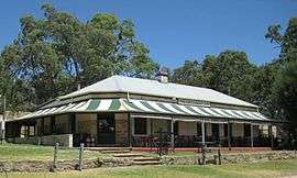 The Greenman Inn | |||||||||||||||
 Ashbourne | |||||||||||||||
| Coordinates | 35°16′58″S 138°46′12″E / 35.28278°S 138.77000°ECoordinates: 35°16′58″S 138°46′12″E / 35.28278°S 138.77000°E | ||||||||||||||
| Population | 281 (2016 census)[1] | ||||||||||||||
| Postcode(s) | 5157[2] | ||||||||||||||
| Location | 43 km (27 mi) from Adelaide | ||||||||||||||
| LGA(s) | Alexandrina Council[3] | ||||||||||||||
| Region | Fleurieu and Kangaroo Island[4] | ||||||||||||||
| County | Hindmarsh[3] | ||||||||||||||
| State electorate(s) | Heysen[3] | ||||||||||||||
| Federal Division(s) | Mayo[3] | ||||||||||||||
| |||||||||||||||
| Footnotes |
Locations[2] Adjoining localities[3] | ||||||||||||||
Ashbourne is a small town in South Australia situated roughly halfway between Meadows and Goolwa, approximately 14 kilometres from the town of Strathalbyn. At the 2016 census, Ashbourne had a population of 281.[1]
History
Ashbourne was laid out in 1865 by C. S. Keeling on Bull's Creek in part of his land in the district known as "Finniss Flat".[5]
School
There is a small school, Eastern Fleurieu School Ashborne Campus. At the moment, 26 students are enrolled here.
Cricket
Despite its small size, Ashbourne has a premier cricket club with several senior and junior grade teams. The Ashbourne Cricket Club, wearing green and gold and known as the Bulls, was established in 1895 and has enjoyed strong links to the Adelaide Oval since that time with founding member and local identity Harry Meyers being closely affiliated with the South Australian Cricket Association (SACA). The soil which formed the Adelaide oval pitches was initially sourced from Ashbourne due to the high suitability of the black clay soils found in the area. The Ashbourne Cricket Club is the longest continuous running club in the Eastern Mount Lofty Ranges and has enjoyed a large degree of success since their formation, particularly from the 1900s to the 1950s where the club dominated the Alexandra Cricket Association. The superb grounds and turf wicket playing surfaces are regarded as being amongst the best in the Greater Adelaide Hills, Fleurieu Peninsula and Murray Lands Regions.
See also
Notes and references
- 1 2 Australian Bureau of Statistics (27 June 2017). "Ashbourne (SA)". 2016 Census QuickStats. Retrieved 6 April 2018.

- 1 2 "Ashbourne, South Australia (Postcode)". postcodes-australia.com. Retrieved 17 April 2017.
- 1 2 3 4 5 "Search result(s) for Ashbourne (LOCB) (Record No. SA0003394) with the following layers being selected – "Parcel labels", "Suburbs and Localities", "Local Government Areas", "Counties", "Place names (gazetteer)" and "Road labels"". Property Location Browser. Government of South Australia. Archived from the original on 12 October 2016. Retrieved 17 April 2017.
- ↑ "Fleurieu and Kangaroo Island SA Government region" (PDF). The Government of South Australia. Retrieved 10 October 2014.
- ↑ "MEADOWS". South Australian Register. Adelaide. 2 October 1865. p. 3. Retrieved 14 April 2014 – via National Library of Australia.
External links