Arvonia, Virginia
| Arvonia, Virginia | |
|---|---|
| Unincorporated community | |
 Arvonia's cemetery flies the American and Welsh flags | |
 Arvonia, Virginia  Arvonia, Virginia | |
| Coordinates: 37°41′01″N 78°20′29″W / 37.68361°N 78.34139°WCoordinates: 37°41′01″N 78°20′29″W / 37.68361°N 78.34139°W | |
| Country | United States |
| State | Virginia |
| County | Buckingham |
| Elevation | 367 ft (112 m) |
| Time zone | UTC-5 (Eastern (EST)) |
| • Summer (DST) | UTC-4 (EDT) |
| Area code(s) | 434 |
| GNIS feature ID | 1462571[1] |
Arvonia is an unincorporated community in Buckingham County, Virginia founded mainly by Welsh immigrants during the 19th century. The town derives its name from the popular port city of Caernarfon, Wales. Its major industry has been slate mining. The slate is known primarily for its color and durability, and is featured on many prominent American buildings, such as the Smithsonian Castle, and the University of Virginia. In 1885 Arvon Presbyterian Church was founded to serve the many Welsh miners in the Slate Quarry. The sanctuary portion of the church was destroyed by fire in 2009 and after being rebuilt to its original design, it reopened on Palm Sunday, April 12, 2012.
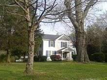
Bryn Arvon and Gwyn Arvon, in Arvonia, are listed on the National Register of Historic Places. Guerrant House and Seven Islands Archeological and Historic District, also NRHP-listed, are both near Arvonia.[2]
References
- ↑ "Arvonia". Geographic Names Information System. United States Geological Survey.
- ↑ National Park Service (2010-07-09). "National Register Information System". National Register of Historic Places. National Park Service.
External links
Municipalities and communities of Buckingham County, Virginia, United States | ||
|---|---|---|
| Town | 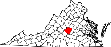 | |
| CDPs | ||
| Unincorporated communities |
| |
| Footnotes | ‡This populated place also has portions in an adjacent county or counties | |