Arroux
| Arroux | |
|---|---|
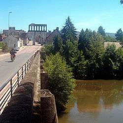 The Arroux in Autun. | |
| Country | France |
| Physical characteristics | |
| Main source | Burgundy |
| River mouth |
Loire 46°29′24″N 3°57′33″E / 46.49000°N 3.95917°ECoordinates: 46°29′24″N 3°57′33″E / 46.49000°N 3.95917°E |
| Length | 129.3 km (80.3 mi) |
| Discharge |
|
| Basin features | |
| Progression | Loire→ Atlantic Ocean |
| Basin size | 3,174 km2 (1,225 sq mi) |
The Arroux is a river in central France, right tributary of the river Loire. It is 129.3 km (80.3 mi) long.[1] Its source is east of Arnay-le-Duc, in Côte-d'Or. The Arroux flows generally south through the following départements and towns:
The Arroux flows into the river Loire near Digoin, the main tributaries are the Ternin (48 km) and the Bourbince (82 km).
References
| Wikimedia Commons has media related to Arroux. |
This article is issued from
Wikipedia.
The text is licensed under Creative Commons - Attribution - Sharealike.
Additional terms may apply for the media files.