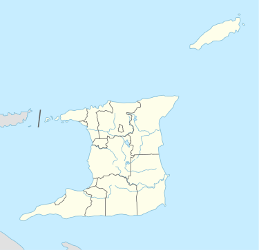
Arouca, Trinidad and Tobago
| Arouca | |
|---|---|
| Town | |
 Arouca Location in Trinidad and Tobago | |
| Coordinates: 10°38′N 61°20′W / 10.633°N 61.333°WCoordinates: 10°38′N 61°20′W / 10.633°N 61.333°W | |
| Country | Trinidad and Tobago |
| Region | Tunapuna–Piarco |
| Population (2011) | |
| • Total | 10,869 |
| Time zone | UTC−4 (AST) |
| Area code(s) | 692 |
| Website |
www |
Arouca is a town in the East–West Corridor of Trinidad and Tobago located 19 km (12 mi) east of Port of Spain, along the Eastern Main Road. It is located west of Arima, east of Tunapuna and Tacarigua, south of Lopinot, and north of Piarco. It is governed by the Tunapuna–Piarco Regional Corporation. Arouca may be a corruption of Arauca, an Amerindian tribe.
During most of the Spanish rule, Arouca was a settlement reserved for Amerindians. However, when the French arrived in 1783 under Governor José María Chacón's Cedula de Repoblación the Amerindians were restricted to Arima. Most of the land in Arouca was split between the Tablau and Chaumet families. Arouca steadily grew into a major agricultural center, but the extension of the railroad to Sangre Grande in 1898 lured many people in Arouca to relocate to the more prosperous Sangre Grande valley.
Today, it mainly comprises residential housing. There is the Bon Air Primary School, Arouca Anglican, Arouca Girls R.C., Arouca Boys R.C. and Arouca Government Primary Schools. There is one newly built secondary school: Bon Air High School.
Golden Grove Prison is located in Arouca.
Prominent people from Arouca
Gallery
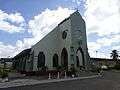 Holy Trinity Church
 Eastern Main Road
 Arouca
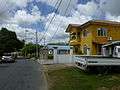 Arouca
References
- Anthony, Michael (2001). Historical Dictionary of Trinidad and Tobago. Lanham, Maryland, and London: Scarecrow Press, Inc. ISBN 0-8108-3173-2.
External links