Arnamul
| Gaelic name | Arnamuil |
|---|---|
| Norse name | Arnamul |
| Meaning of name | Norse for "erne mound" |
| Location | |
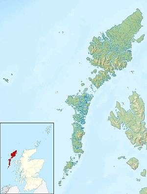 Arnamul Arnamul shown within the Outer Hebrides | |
| OS grid reference | NL545825 |
| Coordinates | 56°48′N 7°40′W / 56.80°N 7.66°W |
| Physical geography | |
| Island group | Uists and Barra |
| Highest elevation | c.150 metres (490 ft) |
| Administration | |
| Sovereign state | United Kingdom |
| Country | Scotland |
| Council area | Na h-Eileanan Siar |
| Demographics | |
| Population | nil |
| References | [1][2] |
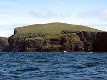
The western cliffs of Mingulay with Arnamuil in the centre
Arnamul (Scottish Gaelic: Arnamuil) is a stack off the west coast of Mingulay in the Western Isles, Scotland. Although precipitous, sheep were grazed on its relatively flat summit during the human occupation of Mingulay.[1]
Haswell-Smith (2004) states that the name means "erne mound". Mac an Tailleir (2003) does not provide a derivation, although he quotes "Arnabol" as meaning "eagle farm" or "Arne's farm" from the Norse.[1][3]
It was ascended by a party of hill baggers in April 2018.
Footnotes
- 1 2 3 Haswell-Smith, Hamish (2004). The Scottish Islands. Edinburgh: Canongate. ISBN 978-1-84195-454-7. p. 211.
- ↑ "Get-a-map" Ordnance Survey
- ↑ Iain Mac an Tailleir (2003). "Placenames" (PDF). Pàrlamaid na h-Alba. Retrieved 2007-07-23.
This article is issued from
Wikipedia.
The text is licensed under Creative Commons - Attribution - Sharealike.
Additional terms may apply for the media files.