Arapaho, Oklahoma
| Arapaho, Oklahoma | |
|---|---|
| Town | |
 Location of Arapaho, Oklahoma | |
| Coordinates: Coordinates: 35°34′37″N 98°57′45″W / 35.57694°N 98.96250°W | |
| Country | United States |
| State | Oklahoma |
| County | Custer |
| Area | |
| • Total | 0.698702 sq mi (1.809630 km2) |
| • Land | 0.698702 sq mi (1.809630 km2) |
| • Water | 0.0 sq mi (0.0 km2) |
| Elevation | 1,669 ft (509 m) |
| Population (2010) | |
| • Total | 796 |
| Time zone | UTC-6 (Central (CST)) |
| • Summer (DST) | UTC-5 (CDT) |
| ZIP code | 73620 |
| Area code(s) | 580 |
| FIPS code | 40-02500[1] |
| GNIS feature ID | 1089676[2] |
Arapaho is a town in and county seat of Custer County, Oklahoma, United States.[3] The population was 796 at the 2010 census, a 6.4 percent increase from 748 at the 2000 census.[4] The town lies long U.S. Route 183. It is named for the Arapaho Native American tribe.
History
The area containing present Arapaho was surveyed by federally-contracted surveyors in 1891, prior to the Cheyenne-Arapaho land opening on 19 April 1892. A US post office was set up for the proposed community on 23 March 1892.
On 19 April 1892, the expected inrush of settlers did materialize; by sundown some 400 claims had been posted. The first town newspaper was issued 10 days later, titled The Arapahoe Arrow (by the end of the year its name had changed to The Arapahoe Bee).
Several Protestant church groups had been organized during the first few years. By 1894 the county courthouse and a school had been built. A lending library was in operation by May 1904.
The Oklahoma Territorial Legislature approved the incorporation on 2 March 1905 (Council Bill #80). The county courthouse had been lost in an 1896 fire, and was not replaced until 1935, built with Public Works Administration funds. It was enlarged in 1985.[5]
Geography
Arapaho is located at 35°34′37″N 98°57′45″W / 35.57694°N 98.96250°W (35.577014, -98.962370).[6]
According to the United States Census Bureau, the town has a total area of 0.7 square miles (1.8 km2), all of it land.
Climate
| Climate data for Arapaho, Oklahoma | |||||||||||||
|---|---|---|---|---|---|---|---|---|---|---|---|---|---|
| Month | Jan | Feb | Mar | Apr | May | Jun | Jul | Aug | Sep | Oct | Nov | Dec | Year |
| Average high °F (°C) | 49.1 (9.5) |
54.4 (12.4) |
64.5 (18.1) |
74.6 (23.7) |
82.4 (28) |
91 (33) |
97.1 (36.2) |
95.7 (35.4) |
86.5 (30.3) |
75.7 (24.3) |
61.7 (16.5) |
51.2 (10.7) |
73.7 (23.2) |
| Average low °F (°C) | 24.0 (−4.4) |
28.5 (−1.9) |
37.0 (2.8) |
47.3 (8.5) |
56.6 (13.7) |
65.7 (18.7) |
70.4 (21.3) |
69.0 (20.6) |
61.2 (16.2) |
49.2 (9.6) |
37.3 (2.9) |
27.4 (−2.6) |
47.8 (8.8) |
| Average precipitation inches (mm) | 0.9 (23) |
1.2 (30) |
2.0 (51) |
2.3 (58) |
4.9 (124) |
4.2 (107) |
2.1 (53) |
3.2 (81) |
3.7 (94) |
2.8 (71) |
1.8 (46) |
1.0 (25) |
30.2 (767) |
| Source: Weatherbase.com[7] | |||||||||||||
Public education
The public education system of the town is combined with that of nearby Butler, Oklahoma. The Arapaho-Butler Public School System operates an elementary school (preK-6th grade) and a high school (7th-12th grade). Both schools are located in Arapaho, adjacent to each other on north 12th Avenue.[8] The two schools had a combined enrollment of 280 in 2000.[5]
Demographics
| Historical population | |||
|---|---|---|---|
| Census | Pop. | %± | |
| 1900 | 253 | — | |
| 1910 | 713 | 181.8% | |
| 1920 | 326 | −54.3% | |
| 1930 | 414 | 27.0% | |
| 1940 | 401 | −3.1% | |
| 1950 | 311 | −22.4% | |
| 1960 | 351 | 12.9% | |
| 1970 | 531 | 51.3% | |
| 1980 | 851 | 60.3% | |
| 1990 | 802 | −5.8% | |
| 2000 | 748 | −6.7% | |
| 2010 | 796 | 6.4% | |
| Est. 2015 | 826 | [9] | 3.8% |
| U.S. Decennial Census[10] | |||
As of the 2010 census, there were 796 people residing in the town.[11] The population density was 1,067.4 people per square mile (412.6/km²). There were 289 housing units at an average density of 426 per square mile (165/km²). The racial makeup of the town was 87.03% White, 1.20% African American, 5.88% Native American, 1.07% Asian, 2.41% from other races, and 2.41% from two or more races. Hispanic or Latino of any race were 5.61% of the population.
There were 265 households out of which 41.9% had children under the age of 18 living with them, 60.0% were married couples living together, 12.1% had a female householder with no husband present, and 22.3% were non-families. 21.1% of all households were made up of individuals and 11.7% had someone living alone who was 65 years of age or older. The average household size was 2.66 and the average family size was 3.07.
In the town, the population was spread out with 29.1% under the age of 18, 7.9% from 18 to 24, 28.6% from 25 to 44, 23.5% from 45 to 64, and 10.8% who were 65 years of age or older. The median age was 35 years. For every 100 females, there were 97.9 males. For every 100 females age 18 and over, there were 97.8 males.
The median income for a household in the town was $34,271, and the median income for a family was $36,339. Males had a median income of $26,375 versus $20,972 for females. The per capita income for the town was $14,645. About 13.7% of families and 16.1% of the population were below the poverty line, including 24.3% of those under age 18 and 3.1% of those age 65 or over.
References
- ↑ "American FactFinder". United States Census Bureau. Archived from the original on 11 September 2013. Retrieved 31 January 2008.
- ↑ "US Board on Geographic Names". United States Geological Survey. 25 October 2007. Retrieved 31 January 2008.
- ↑ "Find a County". National Association of Counties. Archived from the original on 31 May 2011. Retrieved 7 June 2011.
- ↑ CensusViewer:Arapaho, Oklahoma Population. Retrieved 4 January 2014.
- 1 2 Wilson, Linda D. ARAPAHO, Oklahoma Historical Society
- ↑ "US Gazetteer files: 2010, 2000, and 1990". United States Census Bureau. 12 February 2011. Retrieved 23 April 2011.
- ↑ "Historical Weather for Arapaho, Oklahoma, United States".
- ↑ Arapaho-Butler Public Schools
- ↑ "Annual Estimates of the Resident Population for Incorporated Places: April 1, 2010 to July 1, 2015". Archived from the original on 2 June 2016. Retrieved 2 July 2016.
- ↑ "Census of Population and Housing". Census.gov. Archived from the original on 12 May 2015. Retrieved 4 June 2015.
- ↑ "2010 City Population and Housing Occupancy Status". U.S. Census Bureau. Archived from the original on 26 July 2011. Retrieved 18 October 2013.
External links
Municipalities and communities of Custer County, Oklahoma, United States | ||
|---|---|---|
| Cities | 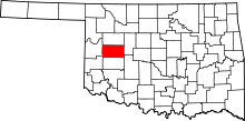 | |
| Towns | ||
| Unincorporated communities | ||
| Ghost town | ||
| Footnotes | ‡This populated place also has portions in an adjacent county or counties | |