Anguri
| Anguri انگوری | |
|---|---|
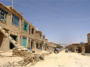 A street in Anguri, 2006 | |
 Anguri Location in Afghanistan | |
| Coordinates: 32°58′06″N 67°32′53″E / 32.96833°N 67.54806°ECoordinates: 32°58′06″N 67°32′53″E / 32.96833°N 67.54806°E | |
| Country |
|
| Province | Ghazni Province |
| District | Jaghori District |
| Time zone | + 4.30 |
Anguri (Persian: انگورى or Angoori or Angori) is a settlement in Jaghori district of Ghazni province in Afghanistan.
In the 1980s-1990s, Anguri was a flashpoint for ethnic violence between Hazara and Pashtun communities.[1]
Education
There is one high school in Anguri (ليسه حتقول و انگوري) which caters for both male and female students a K-12 Education. The high school was established in 1956. Bazar anguri is the well-known trading place which people all over jaghori Province buy their needs from. Dasht-E khakrez is located in north anguri which there is the new build osatd fazil's high school is located. Anguri shares borders with Sang-e-Shanda and Baderzar from north, and Dawod Zeerak from north east and Bilaw from east. Hutqol is located in West of anguri and there is bal na koh mountains in west of anguri.
See also
References
- ↑ Gilles Dorronsoro (2005). Revolution Unending: Afghanistan, 1979 to the Present. C. Hurst & Co. Publishers. pp. 222–. ISBN 978-1-85065-683-8.