Anadyr River
| Anadyr River | |
|---|---|
 | |
| Country | Siberia, Russian Federation |
| Physical characteristics | |
| Main source | Anadyr Range[1] |
| River mouth |
Gulf of Anadyr 0 m (0 ft) |
| Length | 1,150 km (710 mi) |
| Discharge |
|
| Basin features | |
| Basin size | 191,000 km2 (74,000 sq mi) |
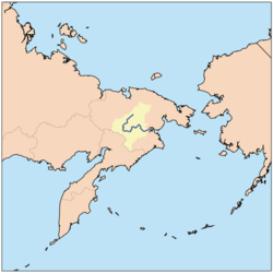
Anadyr (Russian: Ана́дырь) is a river in the far northeast Siberia which flows into Anadyr Bay of the Bering Sea and drains much of the interior of Chukotka Autonomous Okrug. Its basin corresponds to the Anadyrsky District of Chukotka.
Geography
The Anadyr is 1,146 kilometres (712 mi) long and has a basin of 191,000 square kilometres (74,000 sq mi). It is frozen from October to late May and has a maximum flow in June with the snowmelt. It is navigable in small boats for about 570 kilometres (350 mi) to near Markovo. West of Markovo it is in the Anadyr Highlands (moderate mountains and valleys with a few trees) and east of Markovo it moves into the Anadyr lowlands (very flat treeless tundra with lakes and bogs). The drop from Markovo to the sea is less than 100 feet (30 m).
It rises at about 67°N latitude and 173°E longitude near the headwaters of the Maly Anyuy River, flows southwest receiving the waters of the Yablon and Eropol Rivers, turns east and passes Markvovo and the old site of Anadyrsk, turns north and east and receives the Mayn River from the south, thereby encircling the Lebediny Zakaznik, turns northeast to receive the Belaya River (Chukotka) from the north, turns southeast past the Ust-Tanyurer Zakaznik and receives the Tanyurer River from the north. At Lake Krasnoye, it turns east and flows into the Onemen Bay of the Anadyr Estuary. If the Onemen Bay is considered part of the river, it also receives the Velikaya River (Chukotka) from the south and the Kanchalan River from the north.
Its basin is surrounded by (north) Amguyema River and Palyavaam River, (northwest) Bolshoy Anyuy River and the Oloy branch of the Omolon River and (southwest) Penzhina River.
History
In 1648 Semyon Dezhnev reached the mouth of the Anadyr after being shipwrecked on the coast. In 1649 he went upriver and built winter quarters at Anadyrsk. For the next 100 years the Anadyr was the main route from the Arctic to the Pacific and Kamchatka. In the 18th century, the Anadyr was described by the polar explorer Dmitry Laptev.
Ecology
The country through which it passes is thinly populated, and is dominated by tundra, with a rich variety of plant life.[2] Much of the region has beautiful landscapes, dominated by often spectacular, rugged mountains. For nine months of the year the ground is covered with snow, and the frozen rivers become navigable roads. George Kennan, an American working on the Western Union Telegraph Expedition in the late 1860s, found that dog sled travel on the lower Anadyr was limited by lack of firewood.
Reindeer, upon which the local inhabitants subsisted, were once found in considerable numbers,[3] but the domestic reindeer population has collapsed dramatically since the reorganization and privatization of state-run collective farms beginning in 1992. As herds of domestic reindeer have declined, herds of wild caribou have increased.
There are ten species of salmon inhabiting the Anadyr river basin. Every year, on the last Sunday in April, there is an ice fishing competition in the frozen estuarine waters of the Anadyr River's mouth. This festival is locally known as Korfest.
The area is a summering place for a number of migratory birds including brent geese, Eurasian wigeons, and the pintails of California.[4][5]
See also
Notes
- ↑ Anadyr River article in the Great Soviet Encyclopedia (in Russian)
- ↑ The area, which is still sparsely populated today, in 1911 it was described as "thinly populated" (Chisholm 1911).
- ↑ This point was made in 1911: "Reindeer, upon which the inhabitants subsist, are found in considerable numbers" (Chisholm 1911).
- ↑ Henny 1973, pp. 23-29.
- ↑ "Biologist's Journal 2001" Western Ecological Research Center, United States Geological Survey
References

- Henny, Charles J. (January 1973). "Drought Displaced Movement of North American Pintails into Siberia". The Journal of Wildlife Management. 37 (1): 23–29. doi:10.2307/3799734.
External links
- "Tourist and environmental information" Chukotka Autonomous Okrug website, in English
- "Russia Far East: Anadyr River" Wild Salmon Center
- "Snezhnoye: a village on the Anadyr' River"