Sam Chai District
| Sam Chai สามชัย | |
|---|---|
| Amphoe | |
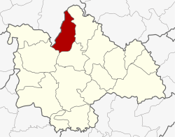 Amphoe location in Kalasin Province | |
| Coordinates: 16°51′48″N 103°32′18″E / 16.86333°N 103.53833°ECoordinates: 16°51′48″N 103°32′18″E / 16.86333°N 103.53833°E | |
| Country | Thailand |
| Province | Kalasin |
| Seat | Samran |
| Area | |
| • Total | 550.853 km2 (212.686 sq mi) |
| Population (2005) | |
| • Total | 25,222 |
| • Density | 45.8/km2 (119/sq mi) |
| Time zone | UTC+7 (ICT) |
| Postal code | 46180 |
| Geocode | 4615 |
Sam Chai (Thai: สามชัย, pronounced [sǎːm t͡ɕʰāj]) is a district (amphoe) in the northern part of Kalasin Province, northeastern Thailand.
Geography
Neighboring districts are (from the east clockwise) Kham Muang, Sahatsakhan, and Nong Kung Si of Kalasin Province and Wang Sam Mo of Udon Thani Province.
History
The minor district (king amphoe) was created on 1 April 1995, when it was split off from Kham Muang District.[1]
On 15 May 2007, all 81 minor districts were upgraded to full districts.[2] With publication in the Royal Gazette on 24 August, the upgrade became official.[3]
Administration
The district is divided into four sub-districts (tambon), which are further subdivided into 46 villages (muban). There are no municipal (thesaban) areas, and four tambon administrative organizations (TAO).
| No. | Name | Thai name | Villages | Pop. | |
|---|---|---|---|---|---|
| 1. | Samran | สำราญ | 12 | 7,800 | |
| 2. | Samran Tai | สำราญใต้ | 19 | 9,068 | |
| 3. | Kham Sang Thiang | คำสร้างเที่ยง | 7 | 3,173 | |
| 4. | Nong Chang | หนองช้าง | 8 | 5,181 |
References
- ↑ ประกาศกระทรวงมหาดไทย เรื่อง แบ่งเขตท้องที่อำเภอคำม่วง จังหวัดกาฬสินธุ์ ตั้งเป็นกิ่งอำเภอสามชัย (PDF). Royal Gazette (in Thai). 112 (Special 9 ง): 54. 22 Mar 1995.
- ↑ แถลงผลการประชุม ครม. ประจำวันที่ 15 พ.ค. 2550 (in Thai). Manager Online.
- ↑ พระราชกฤษฎีกาตั้งอำเภอฆ้องชัย...และอำเภอเหล่าเสือโก้ก พ.ศ. ๒๕๕๐ (PDF). Royal Gazette (in Thai). 124 (46 ก): 14–21. 24 Aug 2007.