Kham Muang District
| Kham Muang คำม่วง | |
|---|---|
| Amphoe | |
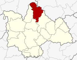 Amphoe location in Kalasin Province | |
| Coordinates: 16°55′24″N 103°37′54″E / 16.92333°N 103.63167°ECoordinates: 16°55′24″N 103°37′54″E / 16.92333°N 103.63167°E | |
| Country | Thailand |
| Province | Kalasin |
| Seat | Thung Khlong |
| Area | |
| • Total | 621.0 km2 (239.8 sq mi) |
| Population (2005) | |
| • Total | 47,412 |
| • Density | 76.3/km2 (198/sq mi) |
| Time zone | UTC+7 (ICT) |
| Postal code | 46180 |
| Geocode | 4610 |
Kham Muang (Thai: คำม่วง, pronounced [kʰām mûa̯ŋ]) is the northernmost district (amphoe) of Kalasin Province, northeastern Thailand.
Geography
Neighboring districts are (from the southeast clockwise) Somdet, Sahatsakhan, Sam Chai of Kalasin Province, Wang Sam Mo of Udon Thani Province, Kut Bak and Phu Phan of Sakon Nakhon Province.
History
The minor district (king amphoe) was established on 1 October 1972, when the three tambon Thung Khlong, Phon, and Sam Ron were split off from Sahatsakhan District.[1] It was upgraded to a full district on 8 September 1976.[2]
Administration
The district is divided into six sub-districts (tambon), which are further subdivided into 70 villages (muban). There are two townships (thesaban tambon): Kha Muang covers parts of the tambon Thung Khlong and Phon parts of the same-named tambon. There are a further six tambon administrative organizations (TAO).
| No. | Name | Thai name | Villages | Pop. | |
|---|---|---|---|---|---|
| 1. | Thung Khlong | ทุ่งคลอง | 12 | 8,696 | |
| 2. | Phon | โพน | 10 | 6,755 | |
| 5. | Din Chi | ดินจี่ | 11 | 6,686 | |
| 6. | Na Bon | นาบอน | 11 | 6,389 | |
| 7. | Na Than | นาทัน | 16 | 13,550 | |
| 9. | Noen Yang | เนินยาง | 10 | 5,336 |
Missing numbers are tambon which now form Sam Chai District.
References
- ↑ ประกาศกระทรวงมหาดไทย เรื่อง แบ่งท้องที่อำเภอสหัสขันธ์ จังหวัดกาฬสินธุ์ ตั้งเป็นกิ่งอำเภอคำม่วง (PDF). Royal Gazette (in Thai). 89 (144 ง special): 5. 28 Sep 1972.
- ↑ พระราชกฤษฎีกาตั้งอำเภอเลาขวัญ อำเภอคำม่วง อำเภอพิปูน อำเภอศรีเทพ อำเภอนาแห้ว อำเภอส่องดาว อำเภอควนกาหลง อำเภอค่ายบางระจัน อำเภอบ้านตาขุน และอำเภอกุดจับ พ.ศ. ๒๕๑๙ (PDF). Royal Gazette (in Thai). 93 (109 ก special): 31–34. 8 Sep 1976.
External links