Khao Yoi District
| Khao Yoi เขาย้อย | |
|---|---|
| District | |
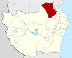 District location in Phetchaburi Province | |
| Coordinates: 13°14′25″N 99°49′27″E / 13.24028°N 99.82417°ECoordinates: 13°14′25″N 99°49′27″E / 13.24028°N 99.82417°E | |
| Country | Thailand |
| Province | Phetchaburi |
| Seat | Khao Yoi |
| Area | |
| • Total | 305.648 km2 (118.011 sq mi) |
| Population (2008) | |
| • Total | 37,697 |
| • Density | 121.8/km2 (315/sq mi) |
| Time zone | UTC+7 (ICT) |
| Postal code | 76140 |
| Geocode | 7602 |
Khao Yoi (Thai: เขาย้อย, pronounced [kʰǎw jɔ́ːj]) is a district (amphoe) in the northern part of Phetchaburi Province, western Thailand.
History
The district was established in 1897 and Luang Phromsan (หลวงพรหมสาร) was assigned as the first district officer. At first named Huai Luang, the district was renamed Khao Yoi in 1903 due to the site of the district office.[1] The name of the district comes from the limestone hill called Khao Yoi which is just off Phetkasem highway. The hill contains three caves, one of which has been converted to a cave temple with a notable reclining Buddha.
Geography
Neighboring districts are (from the north clockwise) Pak Tho of Ratchaburi Province, Amphawa of Samut Songkhram Province, Ban Laem, Mueang Phetchaburi, Ban Lat, and Nong Ya Plong of Phetchaburi Province.
Administration
The district is divided into 10 sub-districts (tambons), which are further subdivided into 59 villages (mubans). The sub-district municipality (thesaban tambon) Khao Yoi covers parts of tambons Khao Yoi, Sa Phang, Bang Khem, and Thap Khang. There are a further seven tambon administrative organizations (TAO) responsible for the non-municipal area.
| No. | Name | Thai | Villages | Pop.[2] |
|---|---|---|---|---|
| 1. | Khao Yoi | เขาย้อย | 7 | 6,873 |
| 2. | Sa Phang | สระพัง | 4 | 3,296 |
| 3. | Bang Khem | บางเค็ม | 6 | 3,834 |
| 4. | Thap Khang | ทับคาง | 5 | 3,548 |
| 5. | Nong Pla Lai | หนองปลาไหล | 5 | 2,692 |
| 6. | Nong Prong | หนองปรง | 6 | 3,935 |
| 7. | Nong Chumphon | หนองชุมพล | 7 | 4,605 |
| 8. | Huai Rong | ห้วยโรง | 4 | 2,507 |
| 9. | Huai Tha Chang | ห้วยท่าช้าง | 8 | 2,034 |
| 10. | Nong Chumphon Nuea | หนองชุมพลเหนือ | 7 | 4,373 |
References
- ↑ แจ้งความกระทรวงมหาดไทย เรื่อง เปลี่ยนชื่อ อำเภอพันลาน แขวงเมืองนครสวรรค์ เป็นอำเภอเกยไชย อำเภอเกลือ แขวงเมืองชลบุรี เป็นอำเภอบางละมุง อำเภอท่าช้าง แขวงเมืองนครนายก เป็นอำเภอบ้านนา อำเภอห้วยหลวง แขวงเมืองเพชรบุรีเป็นอำเภอเขาย้อย (PDF). Royal Gazette (in Thai). 20 (30): 498. 1903-10-25.
- ↑ "Population statistics 2008". Department of Provincial Administration. Archived from the original on 2009-06-09.
External links
- amphoe.com (Thai)