Bang Klam District
| Bang Klam บางกล่ำ | |
|---|---|
| Amphoe | |
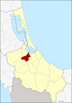 Amphoe location in Songkhla Province | |
| Coordinates: 7°5′21″N 100°24′39″E / 7.08917°N 100.41083°ECoordinates: 7°5′21″N 100°24′39″E / 7.08917°N 100.41083°E | |
| Country | Thailand |
| Province | Songkhla |
| Seat | Bang Klam |
| Tambon | 4 |
| Muban | 36 |
| Amphoe established | 1986 |
| Area | |
| • Total | 147.8 km2 (57.1 sq mi) |
| Population (2014) | |
| • Total | 30,250 |
| • Density | 185.3/km2 (480/sq mi) |
| Time zone | UTC+7 (ICT) |
| Postal code | 90110 |
| Geocode | 9014 |
Bang Klam (Thai: บางกล่ำ, pronounced [bāːŋ klàm]) is a district (amphoe) of Songkhla Province, southern Thailand.
History
The minor district (king amphoe) was established on 7 January 1986 by splitting off four tambon from Hat Yai district.[1] It was upgraded to a full district on 8 September 1995.[2]
Geography
Neighboring districts are (from the south clockwise) Hat Yai, Rattaphum, and Khuan Niang. To the northeast is the Songkhla lake.
Administration
Central administration
The district Bang Klam is divided into four sub-districts (tambon), which are further subdivided into 36 administrative villages (muban).
| No. | Name | Thai | Villages | Pop.[3] |
|---|---|---|---|---|
| 1. | Bang Klam | บางกล่ำ | 7 | 3,718 |
| 2. | Tha Chang | ท่าช้าง | 18 | 20,578 |
| 3. | Mae Thom | แม่ทอม | 6 | 2,277 |
| 4. | Ban Han | บ้านหาร | 5 | 3,677 |
Local administration
There are two sub-district municipalities (thesaban tambon) in the district:
- Tha Chang (Thai: เทศบาลตำบลท่าช้าง) consisting of sub-district Tha Chang.
- Ban Han (Thai: เทศบาลตำบลบ้านหาร) consisting of sub-district Ban Han.
There are 2 subdistrict administrative organizations (SAO) in the district:
- Bang Klam (Thai: องค์การบริหารส่วนตำบลบางกล่ำ) consisting of sub-district Bang Klam.
- Mae Thom (Thai: องค์การบริหารส่วนตำบลแม่ทอม) consisting of sub-district Mae Thom.
References
- ↑ ประกาศกระทรวงมหาดไทย เรื่อง แบ่งเขตท้องที่อำเภอหาดใหญ่ จังหวัดสงขลา ตั้งเป็นกิ่งอำเภอบางกล่ำ (PDF). Royal Gazette (in Thai). 103 (9 ง): 161. January 21, 1986.
- ↑ พระราชกฤษฎีกาตั้งอำเภอด่านมะขามเตี้ย อำเภอแก่งหางแมว อำเภอภักดีชุมพล อำเภอเวียงแก่น อำเภอแม่วาง อำเภอถ้ำพรรณรา อำเภอบ่อเกลือ อำเภอโนนสุวรรณ อำเภอห้วยราช อำเภอแม่ลาน อำเภอบางแก้ว อำเภอป่าพะยอม อำเภอหนองม่วงไข่ อำเภอยางสีสุราช อำเภอจังหาร อำเภอบ้านธิ อำเภอภูสิงห์ อำเภอบางกล่ำ อำเภอวังม่วง และอำเภอนายูง พ.ศ. ๒๕๓๘ (PDF). Royal Gazette (in Thai). 112 (32 ก): 1–3. August 8, 1995.
- ↑ "Population statistics 2014" (in Thai). Department of Provincial Administration. Retrieved 2015-06-09.
External links
This article is issued from
Wikipedia.
The text is licensed under Creative Commons - Attribution - Sharealike.
Additional terms may apply for the media files.