Ampelokipoi, Thessaloniki
| Ampelokipoi Αμπελόκηποι | |
|---|---|
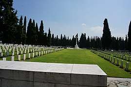 WWI Zeitenlik cemetery in the area | |
 Ampelokipoi Location within the regional unit  | |
| Coordinates: 40°39′N 22°55′E / 40.650°N 22.917°ECoordinates: 40°39′N 22°55′E / 40.650°N 22.917°E | |
| Country | Greece |
| Administrative region | Central Macedonia |
| Regional unit | Thessaloniki |
| Municipality | Ampelokipoi-Menemeni |
| • Municipal unit | 1.803 km2 (0.696 sq mi) |
| Elevation | 5 m (16 ft) |
| Population (2011)[1] | |
| • Municipal unit | 37,381 |
| • Municipal unit density | 21,000/km2 (54,000/sq mi) |
| Time zone | UTC+2 (EET) |
| • Summer (DST) | UTC+3 (EEST) |
| Postal code | 561 21, 561 23 |
| Area code(s) | +30231 |
| Vehicle registration | Ν |
| Website | www.ampelokipoi.gr |
Ampelokipoi (Greek: Αμπελόκηποι, "vineyards") is a suburb of the Thessaloniki Urban Area and was a former municipality of the regional unit of Thessaloniki, Greece. Since the 2011 local government reform it is part of the municipality of Ampelokipoi-Menemeni, of which it is a municipal unit.[2] The population was 37381 in 2011,[1] with a land area of 1.803 km².[3] Ampelokipoi is the seat of the new Ampelokipoi-Menemeni municipality.
Neighbouring places/municipalities
Sport activities
The municipal sports club AO Ampelokipon has football, basketball, volleyball, swimming and athletic clubs. The local stadium was a training center for Olympic Games of 2004.
Education
The municipality has many problems in this sector because of the lack of school buildings and overpopulation.
References
- 1 2 "Απογραφή Πληθυσμού - Κατοικιών 2011. ΜΟΝΙΜΟΣ Πληθυσμός" (in Greek). Hellenic Statistical Authority.
- ↑ Kallikratis law Greece Ministry of Interior (in Greek)
- ↑ "Population & housing census 2001 (incl. area and average elevation)" (PDF) (in Greek). National Statistical Service of Greece. Archived from the original (PDF) on 2015-09-21.
External links
- Official website (in Greek)
This article is issued from
Wikipedia.
The text is licensed under Creative Commons - Attribution - Sharealike.
Additional terms may apply for the media files.