Amaya, Texas
| Amaya, Texas | |
|---|---|
| CDP | |
| Coordinates: 28°42′50″N 99°50′9″W / 28.71389°N 99.83583°W | |
| Country | United States |
| State | Texas |
| County | Zavala |
| Area | |
| • Total | 0.2 sq mi (0.5 km2) |
| • Land | 0.2 sq mi (0.5 km2) |
| • Water | 0.0 sq mi (0 km2) |
| Population (2010) | |
| • Total | 93 |
| • Density | 470/sq mi (180/km2) |
| Time zone | UTC-6 (Central (CST)) |
| • Summer (DST) | UTC-5 (CDT) |
| Zip Code | 78839 |
| FIPS code | 4803008 |
Amaya is a census-designated place (CDP) in Zavala County, Texas, United States. This was a new CDP formed from parts of the former Las Colonias CDP prior to the 2010 census with a population of 93.[1]
Geography
Amaya is located at 28°42′50″N 99°50′9″W / 28.71389°N 99.83583°W (28.713886, -99.835838). The CDP has a total area of 0.2 square miles (0.52 km2), all land.[2]
References
- ↑ "Population and Housing Unit Counts, 2010 Census of Population and Housing" (PDF). Texas: 2010. Retrieved 9 January 2017.
- ↑ "US Gazetteer Files 2016-Places-Texas". US Census. Retrieved 9 January 2017.
Municipalities and communities of Zavala County, Texas, United States | ||
|---|---|---|
| City | 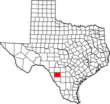 | |
| CDPs | ||
This article is issued from
Wikipedia.
The text is licensed under Creative Commons - Attribution - Sharealike.
Additional terms may apply for the media files.