Altos de Nsork National Park
| Altos de Nsork National Park | |
|---|---|
|
IUCN category II (national park) | |
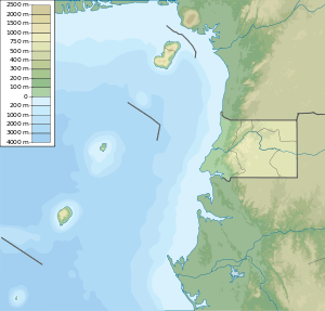
.png) Boundaries of Altos de Nsork (green shaded area) | |
  | |
| Nearest city | Nsok |
| Coordinates | 1°10′N 11°07′E / 1.16°N 11.12°ECoordinates: 1°10′N 11°07′E / 1.16°N 11.12°E |
| Area | 70,000 hectares (270 sq mi) |
The Altos de Nsork National Park (Spanish: Parque nacional de Los Altos de Nsork) is found in Equatorial Guinea. It was established in 2000. The park covers 700 square kilometres (270 sq mi).[1] The area is bounded on the west side by the Abang River, and on the east and south by roads; there are few roads in the park.[2]
Topography and climate
The terrain is one of high hills, with low and dissected terraces. The area is bounded on the west side by the Abang River, and on the east ans south by roads; there are few roads in the park.[2]
References
- ↑ "Altos de Nsork National Park". ProtectedPlanet.net. World Database on Protected Areas. Retrieved 2014-01-03.
- 1 2 "National Parks and Protected Areas". Ikuska. Retrieved 22 March 2016.
This article is issued from
Wikipedia.
The text is licensed under Creative Commons - Attribution - Sharealike.
Additional terms may apply for the media files.