Cueto, Cuba
| Cueto | |
|---|---|
| Municipality | |
.png) Cueto municipality (red) within Holguín Province (yellow) and Cuba | |
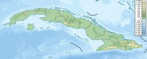
 Location of Cueto in Cuba | |
| Coordinates: 20°38′53″N 75°55′54″W / 20.64806°N 75.93167°WCoordinates: 20°38′53″N 75°55′54″W / 20.64806°N 75.93167°W | |
| Country |
|
| Province | Holguín |
| Area[1] | |
| • Total | 326 km2 (126 sq mi) |
| Elevation | 55 m (180 ft) |
| Population (2004)[2] | |
| • Total | 34,503 |
| • Density | 105.8/km2 (274/sq mi) |
| Time zone | UTC-5 (EST) |
| Area code(s) | +53-24 |
Cueto is a municipality and town in the Holguín Province of Cuba.
Geography
The municipality is located southwest of its province, next to the border with Santiago de Cuba Province. It borders with the municipalities of Báguanos, Mayarí, Mella and Urbano Noris (San Germán). The municipal territory includes the villages of Alto Cedro, Barajagua, Birán,[3][4][5] Marcané, and other minor localities.[6]
Birán, best known as the birthplace of Fidel, Raúl and Ramón Castro, was part of the neighboring municipality of Mayarí until the 1976 reform.[7]
Demographics
In 2004, the municipality of Cueto had a population of 34,503.[2] With a total area of 326 km2 (126 sq mi),[1] it has a population density of 105.8/km2 (274/sq mi).
Popular culture
The name of the town, along with its municipal villages of Alto Cedro and Marcané, figures in the song of the 1940s, "Voy para Mayarí" ("I'm going to Mayarí") by Compay Segundo, and in his song from the Buena Vista Social Club, "Chan Chan".
See also
References
- 1 2 Statoids. "Municipios of Cuba". Retrieved 2007-10-05.
- 1 2 Atenas.cu (2004). "2004 Population trends, by Province and Municipality". Archived from the original on September 27, 2007. Retrieved 2007-10-05. (in Spanish)
- ↑ (in Spanish) Birán on EcuRed
- ↑ 5904273 Cueto on OpenStreetMap
- ↑ 1336109283 Birán on OpenStreetMap
- ↑ 5904273 Cueto on OpenStreetMap
- ↑ Mayarí on guije.com
External links
| Wikimedia Commons has media related to Cueto. |