Altenberg (Limpurg Hills)
| Altenberg | |
|---|---|
 The summit during the construction of the tower | |
| Highest point | |
| Elevation | 564.7 m (1,853 ft) |
| Coordinates | 48°57′46″N 09°54′07″E / 48.96278°N 9.90194°ECoordinates: 48°57′46″N 09°54′07″E / 48.96278°N 9.90194°E |
| Geography | |
 Altenberg | |
| Parent range | Limpurg Hills |
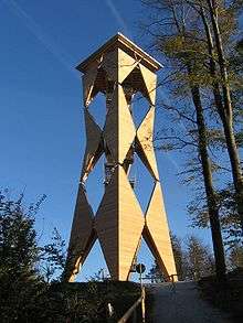
The Altenberg Tower from the NW
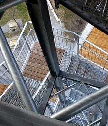
View of the staircase
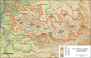
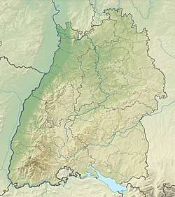
The Altenberg in the Limpurg Hills in the central eastern part of the Swabian-Franconian Forest
The Altenberg is the highest summit in the Limpurg Hills in southwest Germany, reaching a height of 564.7 m above sea level (NHN) and rising some 60 metres above the surrounding area. It lies east of Hohenberg, a village in the municipality of Sulzbach-Laufen, within the county of Schwäbisch Hall in the state of Baden-Württemberg.
Altenberg Tower
At the summit is the Altenberg Tower, a 38.3-metre-high[1] observation tower The tower was opened on 7 October 2007[2] and measures 36 metres from the ground to the observation platform. As a result the fully covered viewing point is at a height of about 600 m.
Access
- From the newly built visitor car park east of Hohenberg, a gravelled path runs for a good 300 metres directly to the summit.
- A much longer and higher, but less steep path runs fromd the farm of Altenberg about 500 metres south of Hohenberg.
- In addition, various paths run from the east from the road between Hohenberg and Wegstetten as from the south from the Abtsklinge.
References
- ↑ Altenbergturm, at sulzbach-laufen.de
- ↑ Weitere Infos für Neubau, dated 9 August 2014, at echo-online.de
External links
| Wikimedia Commons has media related to Altenbergturm. |
- Altenbergturm, at sulzbach-laufen.de via Internet Archive
- Topographic map with the Altenberg, in the geodata viewer at geoportal-bw.de
- 360-degree panorama from the Altenberg Tower (Description of what's visible switchable), at panorama-photo.net
This article is issued from
Wikipedia.
The text is licensed under Creative Commons - Attribution - Sharealike.
Additional terms may apply for the media files.