Almanor, California
| Almanor | |
|---|---|
| census-designated place | |
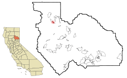 Location in Plumas County and the state of California | |
 Almanor Location in the United States | |
| Coordinates: 40°13′1″N 121°10′38″W / 40.21694°N 121.17722°WCoordinates: 40°13′1″N 121°10′38″W / 40.21694°N 121.17722°W | |
| Country |
|
| State |
|
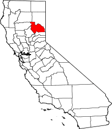
| County | Plumas |
| Area[1] | |
| • Total | 0.88 sq mi (2.29 km2) |
| • Land | 0.88 sq mi (2.29 km2) |
| • Water | 0.00 sq mi (0.00 km2) 0% |
| Elevation[2] | 4,554 ft (1,388 m) |
| Population (2010) | |
| • Total | 0 |
| • Estimate (2016)[3] | N/A |
| Time zone | UTC-8 (Pacific (PST)) |
| • Summer (DST) | UTC-7 (PDT) |
| ZIP code | 95947 |
| Area code(s) | 530 |
| FIPS code | 06-01094 |
| GNIS feature IDs | 256193; 2407722 |
| U.S. Geological Survey Geographic Names Information System: Almanor, California; U.S. Geological Survey Geographic Names Information System: Almanor, California | |
Almanor (formerly, Plumas Pines)[4] was a census-designated place (CDP) in Plumas County, California, United States.[5] The population was 0 at the 2010 Census.[6] Almanor is located 7 miles (11.3 km) south-southeast of Chester.[4]
History
The name comes from three daughters of Guy C. Earl, president of the Great Western Power Co.: "Alice", "Martha", and "Elinor".[4] The Almanor post office opened in 1926.[4]
Geography
Almanor is located at 40°13′1″N 121°10′38″W / 40.21694°N 121.17722°W (40.216857, -121.177325),[7] on the south-west shoreline of Lake Almanor.
According to the United States Census Bureau, the CDP has a total area of 0.9 square miles (2.3 km2), all land.
Demographics
| Historical population | |||
|---|---|---|---|
| Census | Pop. | %± | |
| U.S. Decennial Census[8] | |||
As of the 2010 Census,[9] there were no people living in the CDP.
References
- ↑ "2016 U.S. Gazetteer Files". United States Census Bureau. Retrieved Jul 19, 2017.
- ↑ U.S. Geological Survey Geographic Names Information System: Almanor, California
- ↑ "Population and Housing Unit Estimates". Retrieved June 9, 2017.
- 1 2 3 4 Durham, David L. (1998). California's Geographic Names: A Gazetteer of Historic and Modern Names of the State. Clovis, Calif.: Word Dancer Press. p. 351. ISBN 1-884995-14-4.
- ↑ U.S. Geological Survey Geographic Names Information System: Almanor, California
- ↑ "2010 Census P.L. 94-171 Summary File Data". United States Census Bureau.
- ↑ "US Gazetteer files: 2010, 2000, and 1990". United States Census Bureau. 2011-02-12. Retrieved 2011-04-23.
- ↑ "Census of Population and Housing". Census.gov. Retrieved June 4, 2016.
- ↑ "American FactFinder". United States Census Bureau. Archived from the original on 2013-09-11. Retrieved 2008-01-31.
External links
This article is issued from
Wikipedia.
The text is licensed under Creative Commons - Attribution - Sharealike.
Additional terms may apply for the media files.