Almádena
| Almádena | |
|---|---|
| Village | |
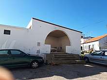
 O Largo do Poço, the village square in Almádena | |
| Coordinates: 37°05′41″N 8°46′06″W / 37.0948°N 8.7684°WCoordinates: 37°05′41″N 8°46′06″W / 37.0948°N 8.7684°W | |
| Country |
|
| Region | Algarve |
| Municipio | Lagos |
| Freguesia | Luz |
| Elevation | 14 m (46 ft) |
| Time zone | UTC0 (WET) |
| • Summer (DST) | UTC-1 (WEST) |
| Postal Zone | 8600-102 Lagos |
| Area Code & Prefix | (+351) 282 XXX-XXXX |
| ISO 3166 code | PT |
Almádena (Portuguese pronunciation: [aɫˈmadɛnɐ]) is a village located in Portugal's western Algarve. Administratively, it is part of the civil parish (freguesia) of Luz, (popularly known as Praia da Luz), and the municipality (município) of Lagos.
Etymology
According to certain authorities, the toponym 'Almádena' has an Arabic origin, like many place names in the area. The name is assumed to derive from the Arabic word for minaret (al-madin).[1]
Geography
The village is located in the Vale de Barão. It lies 3 km north of the fishing village of Burgau and 4 km from Luz itself, just outside of the boundary of the Southwest Alentejo and Vicentine Coast Natural Park.
Almádena's location is on the edge of fertile sedimentary deposits including the 'ribeiras' of Almádena, of Burgau and of the Vale de Barão. Anecdotal evidence suggest that, in the past, the land was very fruitful and that Almádena's inhabitants were the richest in the freguesia of Luz[2] but this may also be because they were also hard working[3].
Local farmers' focused on fig cultivation rather than almonds, olives or carob beans, which were more ubiquitous to the east. However, one additional crop, rice, flourished and was consequently grown in the irrigable lowlands south west of the village.[4]
Buildings
Almádena resembles many rural villages in the Algarve. Its housing stock mainly consists of small white houses with traditional chimneys, a domestic architectural style influenced by the Moorish occupation of the area up to the thirteenth century. There is a small market for farmers' produce and a community centre in the heart of the village as well as several bars and restaurants. The main square in the village (Largo do Poço), unusually, has as its centre-piece a traditional farm well [5].
Nearby buildings of interest include Quinta das Alagoas: A fifteenth century fortified farmhouse and known locally as the " Roman Farm", now converted into accommodation
References
- ↑ De Sousa, João (1830) Vestigios da lingoa arabica em Portugal p53
- ↑ Guerreiro, Catarina Glória (1991) A História Da Minha Terra Nossa De Luz p25
- ↑ Adragão, José Víctor (1985) Algarve p74
- ↑ Stanislawski, Dan (1963) Portugal's Other Kingdom: The Algarve p80
- ↑ Vincente, A.S. (1990) Moçarabe Em Perigrinação p13
External links
- Pictures of Almádena: Places in the South West Algarve