Allt-fawr
| Allt-fawr | |
|---|---|
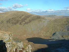 Allt Fawr from the Rhosydd quarry | |
| Highest point | |
| Elevation | 698 m (2,290 ft) |
| Prominence | 243 m (797 ft) |
| Parent peak | Moelwyn Mawr |
| Listing | Marilyn, Hewitt, Nuttall |
| Coordinates | 53°00′27″N 3°58′02″W / 53.00762°N 3.96726°WCoordinates: 53°00′27″N 3°58′02″W / 53.00762°N 3.96726°W |
| Naming | |
| Translation | big slope (Welsh) |
| Pronunciation | Welsh: [ˈaɬt ˈvaur] |
| Geography | |
| Parent range | Snowdonia |
| OS grid | SH681474 |
| Topo map | OS Landranger 115 |
| Listed summits of Allt-fawr | ||||
| Name | Grid ref | Height | Status | |
|---|---|---|---|---|
| Cnicht | 689 m (2,260 ft) | Hewitt, Nuttall | ||
| Moel Druman | 676 m (2,218 ft) | Hewitt, Nuttall | ||
| Ysgafell Wen | 672 m (2,205 ft) | Hewitt, Nuttall | ||
| Ysgafell Wen North Top | 669 m (2,195 ft) | Hewitt, Nuttall | ||
| Moel Meirch | 609 m (1,998 ft) | sub Hewitt | ||
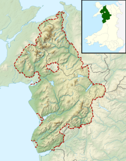
Allt-fawr is a mountain in Snowdonia, North Wales and forms part of the Moelwynion group.
It is on the internal border of Snowdonia National Park, and overlooks the town of Blaenau Ffestiniog, with its numerous slate quarries, as well as the Tanygrisiau reservoir and power station.[1] On the northern slope of Allt-fawr is the Oakeley Quarry, the world's largest underground slate mine. On the southern slope is the large Cwmorthin Quarry. These two mines are joined underneath the summit of Allt-fawr and the extensive chambering and adits are visible on the surface of the mountain where underground workings have collapsed.[2]
References
External links
This article is issued from
Wikipedia.
The text is licensed under Creative Commons - Attribution - Sharealike.
Additional terms may apply for the media files.