Allah Abad, Rahim Yar Khan
| Allah Abad | |
|---|---|
| Town | |
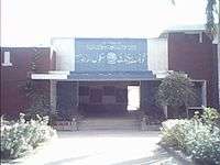 Entrance of Government High School | |
 Allah Abad | |
| Coordinates: 28°56′N 70°58′E / 28.933°N 70.967°ECoordinates: 28°56′N 70°58′E / 28.933°N 70.967°E | |
| Country |
|
| Province | Punjab |
| Area | |
| • Total | 9 km2 (3 sq mi) |
| Population (1998 63566) | |
| • Total | 37,500 |
| Time zone | UTC+5 (PST) |
| Calling code | 068 |
| Languages | Punjabi, Seraiki, Urdu |
Allah Abad is a town and Union Council in Punjab, Pakistan. It is located in tehsil Liaqatpur the district of Rahim Yar Khan.
History
Allah Abad is one of the oldest towns in Bahawalpur. When it was a princely state, Allah Abad was used as a second unofficial capital after Dera Nawab. Now, this town is a union council of Liaquatpur. It has one of the most popular school in Rahimyarkhan District, namely, Allah Abad Government Secondary High School.
Transport
Allahabad is linked with Liaquatpur with two way 6.5 km. asphalt road. On the other end, it is linked with Jan Pur, a main hub on KLP road. On the west with Amin Abad, another town approximately 9 kilometers far from Allah Abad
See also
- Muhammad Saifullah, a former Minister of Religious Affairs in the Government of Pakistan
Neighbourhoods of Rahim Yar Khan | ||
|---|---|---|
Administrations: Rahim Yar Khan District | ||
| Tehsils |  | |
| Cities | ||
| Towns and councils |
| |
| Villages | ||
This article is issued from
Wikipedia.
The text is licensed under Creative Commons - Attribution - Sharealike.
Additional terms may apply for the media files.