Alkuti
| Alkuti अळकुटी | |
|---|---|
| अळकुटी | |
 Alkuti Location in Maharashtra, India  Alkuti Alkuti (India) | |
| Coordinates: 19°03′N 74°14′E / 19.05°N 74.23°ECoordinates: 19°03′N 74°14′E / 19.05°N 74.23°E | |
| Country |
|
| State | Maharashtra |
| District | Ahmadnagar |
| Elevation | 654 m (2,146 ft) |
| Population | |
| • Total |
5,789 area_magnitude= sq. km |
| Languages | |
| • Official | Marathi |
| Time zone | UTC+5:30 (IST) |
| PIN | 414 305 |
| Telephone code | 02488 |
| Vehicle registration | MH-16, MH-17 |
| Nearest city | Parner, Shirur, Narayangaon, Sangamner, Junner, Nighoj. |
| Literacy | 75% |
| Lok Sabha constituency | Ahmednagar |
| Civic agency | Grampanchayat Alkuti |
| Climate | Dry and hot (Köppen) |
| Avg. summer temperature | 40 °C (104 °F) |
| Avg. winter temperature | 15 °C (59 °F) |
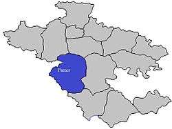
Alkuti is a village in Parner taluka, Ahmadnagar district of Maharashtra state in Indian territory.
Geography
Alkuti has an average elevation of 2,148 feet (655 m). The village is located on intersection of Shirur – Kalyan (State Highway 51). The population of Alkuti is 4850 (2011). Alkuti has a fort which is still owned by the descendants of the Kadambande Family.
Education
- Saurabh Computers
- Samarth coaching classes
- Dnyanprabodhini Coaching Classes
Schools & Colleges
- Jilha Parishad Primary School, Alkuti
- Jilha Parishad Primary School, (Bahirobawadi) Alkuti
- Rayat Kshishan Sanstha's Shri SAINATH Highschool and Jr. college (Science, Arts and MCVC) Alkuti.
- SAI Education Socity's English Medium School Alkuti
- Ashram Shala Alkuti
- Art, Commerce & Science Senior College, Alkuti
Finance
Banks
- Central Bank of India
- Swami Samarth Bank, Nighoj-Alkuti
- Alkuti Gramin Patsanstha
- Senapati bapat Patsantha
- Parner Gramin Patsantha
- Kanhur Pathar Patsanstha
- Nighoj Gramin Patsanstha
- Sai Multistate Patsanstha
References
This article is issued from
Wikipedia.
The text is licensed under Creative Commons - Attribution - Sharealike.
Additional terms may apply for the media files.